WhereGroup | [email protected] @WhereGroup_com
Dienstleistung, Beratung und Programmierung rund um Geodaten Impressum: https://t.co/MRKOfFDcqS wheregroup.com Bonn / Germany Joined May 2011-
Tweets3K
-
Followers677
-
Following205
-
Likes2K
NEU im WhereGroup Blog: 📝 Unser Kollege Martin Alzueta berichtet über seine #Ausbildung zum #Fachinformatiker bei uns – was er in der Zeit gelernt hat und wie seine Zukunftsaussichten in der #GIS-Branche aussieht, können Sie jetzt nachlesen! 👇️ wheregroup.com/blog/details/q…

Online-Schulung der @FOSS_Academy Geodatenmanagement mit #PostgreSQL / #PostGIS an 4 Vormittagen jeweils von 9:00 bis 12:00 Uhr 13.05. - 16.05.2024 foss-academy.com/geodatenmanage… #FOSSGIS #GDI #FOSS4G #OSGeo #GeoSpatial #QGIS

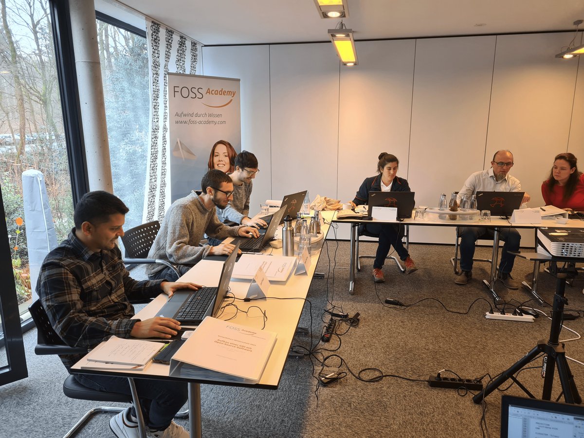
Im @FOSS_Academy Web-Seminar im Juni geht es um den Aufbau einer #GDI mit Open-Source-Software Kostenloses einstündiges Web-Seminar 10.00 - 11.00 Uhr Jetzt schon anmelden! foss-academy.com/web-seminare/ #FOSSGIS #GIS #GEOSPATIAL #FOSS4G #OSGeo #GEOSPATIAL #OS

MoFa4Q ist #opensource! 🥳 Unsere minimalistische QGIS-Fachschale für den mobilen Offline-Einsatz steht ab sofort kostenlos bereit. 👨🏻💻 Jetzt entdecken! 👀 github.com/WhereGroup/qgi… #gis #qgis #offlinegis #gischat
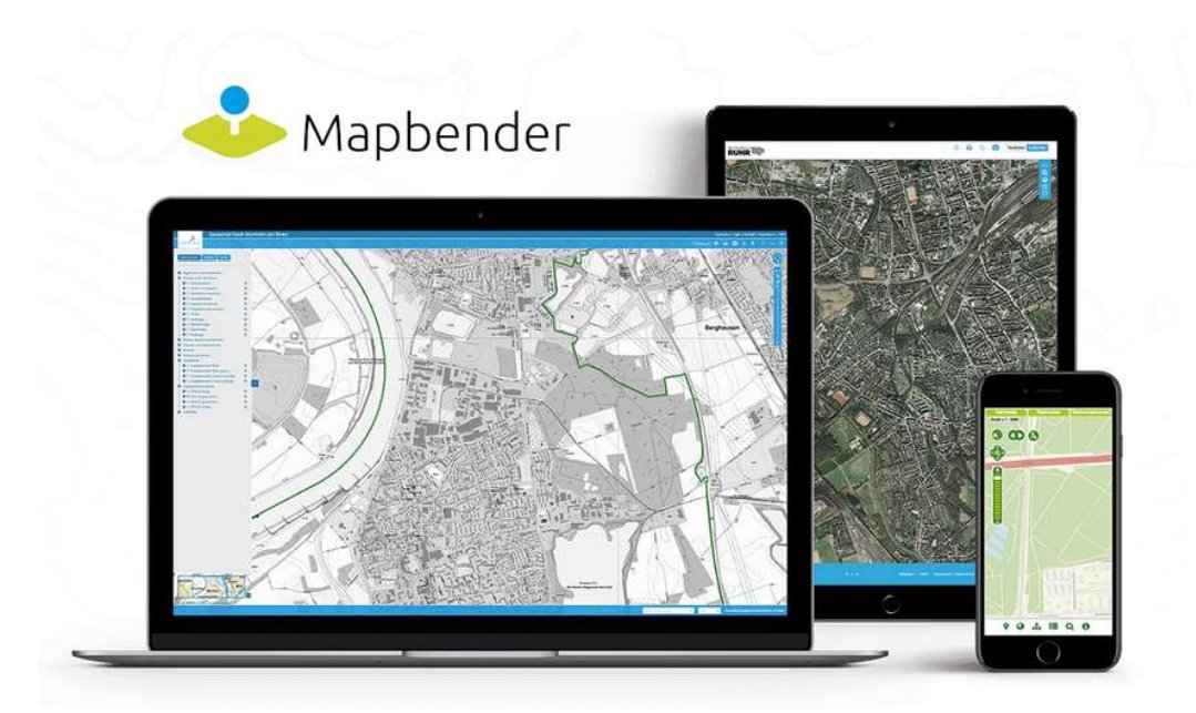
Im nächsten @FOSS_Academy Web-Seminar im Mai geht es um: #Mapbender Version 4 - Neuigkeiten aus dem Projekt 2. Mai 2024 Kostenloses einstündiges Web-Seminar 10.00 - 11.00 Uhr Jetzt schon anmelden! foss-academy.com/web-seminare/ #FOSSGIS #GIS #GEOSPATIAL #FOSS4G #OSGeo #GEOSPATIAL
Im Mai und Juni erwarten Sie @FOSS_Academy Online-Schulungen rund um #QGIS jeweils von 9:00-12:00 Uhr 28.-29.05. Einführung in QGIS 04.-07.06. QGIS für Fortgeschrittene 11.-14.06. QGIS Programmierung mit Python foss-academy.com/termine/ #FOSSGIS #GEOSPATIAL #OSGeo #FOSS4G

Entdecken Sie die Schulungen der @FOSS_Academy! Wir bieten Präsenz-, Online-Schulungen & Web-Seminare. Schulungen rund um #MapServer #PostGIS #PostgreSQL #QGIS #Python #Mapbender #GeoServer #MapProxy #OSM ... foss-academy.com/termine Jetzt buchen! #FOSSGIS #GIS #GEOSPATIAL #OSGeo

NEU im WhereGroup Blog: 📝 In unserem neuesten Blogartikel lassen wir die #Fossgis2024 Revue passieren. Unseren Beitrag zum Event und die Highlights unserer Kolleginnen und Kollegen erfahren Sie in diesem Artikel. Jetzt reinlesen👇️ bit.ly/fossgis24 @FOSSGIS_Konf

The #foss4ge2024 porgram is out. @mapbender will be in Tartu in June with a workshop and a presentation. Meet @astroidex at the event. #mapbender #osgeo #foss4g

The #foss4ge2024 porgram is out. @mapbender will be in Tartu in June with a workshop and a presentation. Meet @astroidex at the event. #mapbender #osgeo #foss4g

Die @FOSS_Academy bietet an jedem ersten Donnerstag im Monat ein kostenloses einstündiges Web-Seminar an. Im Mai geht es um #Mapbender Version 4 - Neuigkeiten aus dem Projekt 2. Mai 2024 10.00 - 11.00 Uhr Anmeldung foss-academy.com/web-seminare/ #fossgis @mapbender #osgeo #foss4g

🎉Great news! 📚The complete FOSS4GE program is now available! Remember also to check out the academic track and workshop schedule.👀 ❗An early bird discount is available for those who register before May 10! 📌2024.europe.foss4g.org/schedule/talks/ #FOSS4GE2024 #FOSS4GE #FOSS4G
NEU im WhereGroup Blog: 📝 Unser Kollege Dr. Christoph Welker erstellt mithilfe von Python eine effektive Brücke zwischen PostgreSQL und Salesforce - um die Daten nahtlos zu synchronisieren & zu aktualisieren. 🔄 Jetzt reinlesen & umsetzen:👇️ wheregroup.com/blog/details/p…
Wir hoffen, dass der Rückblick zur Winterschule Lust macht auf den 5-tägiger Kompaktkurs der @FOSS_Academy zum Aufbau einer #GDI. wheregroup.com/unternehmen/ak… Der nächste Kurs ist vom 2.-6. September 2024 in Bonn foss-academy.com/kompaktkurse/ #FOSSGIS #OSGeo #FOSS4G #GeoSpatial #GIS
We are now 100 days away from the start of FOSS4GE!⌛️ Prepare for an event full of learning, networking, and inspiration.🌟 Keep an eye out for forthcoming updates as we gear up for an unforgettable experience!🚀 📌2024.europe.foss4g.org

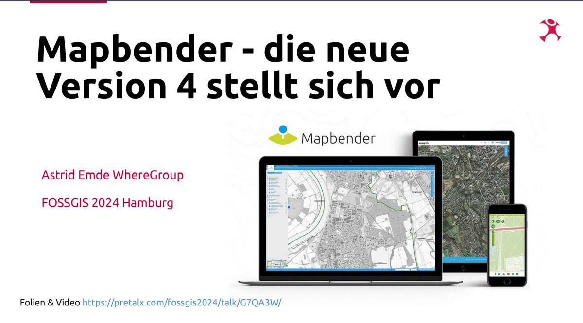
#FOSSGIS2024 #Mapbender war vertreten & hat Lust auf die bald erscheinende Version 4 gemacht. Das Video ist verlinkt Mapbender - die neue Version 4 stellt sich vor pretalx.com/fossgis2024/ta… Mapbender Workshop Schwerpunkt Mapbender 4 pretalx.com/fossgis2024/ta… #OSGeo #FOSSGIS #FOSS4G
#FOSSGIS2024 war voller Anregungen & Ideen für den Einsatz von #OpenSource #Geospatial Software. Die @FOSS_Academy bietet Schulungen zu #Mapbender #MapServer #PostGIS #QGIS #MapProxy #GeoServer & mehr. foss-academy.com/termine/ #FOSSGIS #OSGeo #OSM #FOSS4G


#geoObserver 🌍🔭.. @geoObserver_
2K Followers 1K Following 1. Brauchen wir keinen Raumbezug und 2. ist die Erde eine Scheibe. 1. we do not need a spatial reference and 2. the earth is a disc.
Bundesamt für Kartog.. @BKG_Bund
5K Followers 917 Following 🌐 Wir sind zentraler Geo-Dienstleister des Bundes. #WirGebenOrientierung Netiquette: https://t.co/ap8DtHu7Up

terrestris @terrestrisde
503 Followers 259 Following We provide top-notch Free and OpenSource GIS services, solutions and training from Bonn, Germany | @[email protected]
Hans van der Kwast @h.. @hansakwast
7K Followers 2K Following Associate Prof. @ihedelft | Physical Geographer | Owner of QWAST-GIS | #OpenSource advocacy | board member @qgisnl | @gisocw | @osgeo Charter Member | #QGIS
FOSS Academy @FOSS_Academy
291 Followers 35 Following Schulungsinstitut der WhereGroup. Praxisorientierte Schulungen rund um Geospatial Open-Source-Software. https://t.co/kL5sSA3veJ https://t.co/nCvCnHcOpQ
Mapbender | @mapbende.. @mapbender
869 Followers 19 Following Mapbender is one of the leading open source solutions for creating intuitive and high-performance WebGIS applications. Also at https://t.co/UT9AcArAMz
Geoinformatics Salzbu.. @Z_GIS1
2K Followers 729 Following Department of Geoinformatics @PLUS_1622, EO*GI, integrating basic and applied research with education and outreach - Meet us every July @ https://t.co/t82hhF60sc
DVW e. V. @DVW_eV
848 Followers 200 Following DVW e.V. - Gesellschaft für Geodäsie, Geoinformation und Landmanagement fördert diese Bereiche in Wissenschaft und Praxis. Er ist Veranstalter der INTERGEO.
QGIS @qgis
67K Followers 72 Following Official account of QGIS - the user friendly Open Source Geographic Information System
Geonetzwerk.metropole.. @geonetzwerkmR
441 Followers 449 Following Das Kooperationsprojekt Geonetzwerk.metropoleRuhr hat das Ziel regionalbedeutsame Daten der Region bereitzustellen, nutz- und austauschbar zu machen. @rvr_ruhr
Christine @die_christine
629 Followers 1K Following blond, Geoinformatikerin, @moehrchenzessin s Mama, Hackse, apokalyptische Rheydterin, im ♥ Münsterländerin, REUTX5Y7, @[email protected]
Stichling Geomeet @geomeet
1K Followers 1K Following Beiratsmitglied Deutscher Dachverband f.Geoinformation, #DDGI, (Präsident bis 12/2019) Vermessung Wuppertal/Umgebung,Beratender Ingenieur,ÖBVI; Mündiger Bürger
Josef Strobl @GIStrobl
2K Followers 216 Following Digitally interfacing with the spatial dimensions of our world
FOSSGIS Konferenz @FOSSGIS_Konf
1K Followers 150 Following FOSSGIS Konferenz 2024 vom 20-23.März 2024 • Hamburg • Online • Impressum: https://t.co/tN2AmVwxtV #FOSSGIS #FOSSGIS2024

Wizard of LatLng @_papalapap_
295 Followers 665 Following Geospatial Wizardry. Lazy Running. Coffeneuring. Berlin, London, irgendwo im Nirgendwo.
BDVI Brandenburg, M-V.. @BDVI_Bbg
514 Followers 491 Following Für den Bund der Öffentlich bestellten Vermessungsingenieure Brandenburg, Sachsen-Anhalt, Mecklenburg-Vorpommern twittert Geschäftsstellenleiter Frank Reichert.
Ma Rga @Mamar_ga
0 Followers 8 Following

ole ole @ole_roe
19 Followers 128 Following
Désirée A. @GeoDesi_
120 Followers 1K Following curious geographer who loves to dive into new topics to understand the world and its interconnections better - fighting for environmental justice & feminism

Lisa Butler @LisaButler54810
17 Followers 818 Following
TerraOps - Innovation.. @TerraOpsOrg
2 Followers 69 Following TerraOps specializes in geospatial cloud solutions of OsGEO/FOSS4G stack, offering expert OsGEO software implementation, REST API services, using DevOps methods
Slava Ermolaev @slava_ermolaev
4 Followers 33 Following
Matthias Kuhn @_mkuhn
1K Followers 364 Following Managing geoninja at https://t.co/QMp9HKke60. Developping QGIS and QField.
Tim Gattinger @GattingerTim
597 Followers 2K Following Interests in AI with focus on remote sensing. Works as engineer in a project monitoring forests with remote sensing and AI In Schleswig-Holstein (Germany).
Kristine Souza @souza_kris52906
93 Followers 3K Following
Markus Besenfelder @MbGvHH
5 Followers 39 Following
Wide @shithushe26809
345 Followers 5K Following See the world on the road, and get to know yourself on the way!
Pranav Wilcox @pranav_wil98827
102 Followers 3K Following
Jennifer Day @JenniferDa48813
81 Followers 3K Following
Martin Alzueta @martin_alzueta
2 Followers 8 Following
Dawn @Dawnmapper
11 Followers 317 Following
Sven Gruner @sv3n5on
215 Followers 1K Following Geodät, Fotograf, Bergsteiger, Kletterer, Kaffeegenießer, ...
HelloWorld @HelloWo37553275
56 Followers 58 Following
Brooke @Pousso137369
321 Followers 5K Following See the world on the road, and get to know yourself on the way!
♣️ G.let'sCher �.. @a_q_u_i_l_a
216 Followers 508 Following GIS - Sa†anis†🌐 Für dich, ich führ' dich 🗺️ My battery is low and it's getting dark никто не даст тебе новой попытки

Simon Kuestenmacher @simongerman600
268K Followers 230K Following German #geographer and #demographer in #Melbourne. I curate #maps and #data that explain how the #world works. Obviously all opinions are my own...
Frank Hellwich @FrankHellwich
12 Followers 80 Following

Masterportal @masterportalorg
292 Followers 145 Following Open Source Geoportallösung Masterportal: Neue Features, Erweiterungen und Anwendungsbeispiele sowie Infos rund um die Implementierungspartnerschaft
Andreas Rod @AndreasRod1
37 Followers 503 Following Copywriter mit Herz. Klare Botschaften für Coaches & Verlage. #TextMagier ✍️📚

Julian Manrique @unrolomas
359 Followers 3K Following La inteligencia del individuo se mide por la cantidad de incertidumbres que es capaz de soportar. 🗾🗺️🔭🔬🛰️🚀🌐 Geografía UNAL.
CraftbeerSepp @Setbusta
258 Followers 588 Following Hobbybierbrauer, fränkischer Schwabe, Leidenschaft Fußball. Fan der @SpVggBayreuth und des @VfB.
DimpleJain @JainDimple95
23 Followers 127 Following
DR.MD.ARAFAT RAHMAN @ARAFATBAPPI
60 Followers 5K Following I am Dr. Md. Arafat Rahman Bappi is a Dental Surgeon & also Public Health Specialist.
pomodoren @pomodoren_
149 Followers 690 Following sustainability @GIZAlbania. brainology @unipv. computers @bilkentuniv. Opinions and likings my own.
Lauren Young @Elise11947709
7 Followers 167 Following
سلطان حسن ا�.. @EbnSultan
2K Followers 2K Following دكتوراةهندسةج.طوكيو،أستاذ زائرلجامعتي طوكيو وآكتا- اليابان عضوالشورى2014 إستشاري المعلومات الجيومكانية(الإستشعار عن بعد) Geospatial Counsltant-Remote Sensing
César Suárez H @gaiasie
241 Followers 3K Following Gironés @UIS Opiniones personales 🌋🏃🏽🚵🏽 #geoscience #GIS #remotesensing
Nodes & Code🌍 @laura_mugeha
5K Followers 4K Following #Data for Good | GeoGeek 🗺️ x Community Buider 👥 | 👩🏾💻 @Code4Africa | Open data & FOSS fan @openstreetmap @OSGeo
Tati Pará @tati_para
2K Followers 3K Following Mãe, cria da Amazônia, membra @osgeo, embaixadora @okfnbr e fundadora das @meninasdageo.
Rainer Luginsland @rlugis
0 Followers 79 Following Geographie, Landschaftsökologie, Geoökologie, Stadtentwicklung, Politik, Geschichte, Musik...
Jan Schäfer @schfer_jan
12 Followers 361 Following öffentl. Dienst Vermessung Geodata Data Analytics
Syed Muntazir @geomuntazir1
60 Followers 1K Following
Nabaz @nabazgharib
18 Followers 52 Following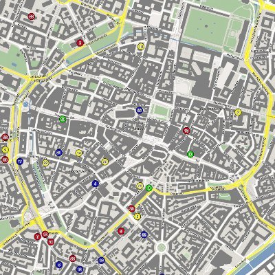

GeoDesk @GeoDeskTeam
157 Followers 550 Following Developers of the fastest and smallest spatial database for @OpenStreetMap data. Analyzing geographic features has never been easier! 100% FOSS 🚀
Oluwafemi Adeyemo @FemdamCladof
157 Followers 407 Following A data scientist who loves deriving insights and solve problems intelligently using data. I love working with both spatial and non-spatial data.
Vinner @VinVner
14 Followers 172 Following
Cesáreo Ruiz @CeroRuz
207 Followers 2K Following Físico. Me interesan los Sistemas Dinámicos y la Complejidad.
#geoObserver 🌍🔭.. @geoObserver_
2K Followers 1K Following 1. Brauchen wir keinen Raumbezug und 2. ist die Erde eine Scheibe. 1. we do not need a spatial reference and 2. the earth is a disc.
Bundesamt für Kartog.. @BKG_Bund
5K Followers 917 Following 🌐 Wir sind zentraler Geo-Dienstleister des Bundes. #WirGebenOrientierung Netiquette: https://t.co/ap8DtHu7Up
cartocalypse.tif @cartocalypse
4K Followers 1 Following QGIS/Python/Carto/Geoviz/Stuff in Hamburg. cartocalypse📧enjoys⚈it @[email protected] Why don't you have a blog?
terrestris @terrestrisde
503 Followers 259 Following We provide top-notch Free and OpenSource GIS services, solutions and training from Bonn, Germany | @[email protected]
Hans van der Kwast @h.. @hansakwast
7K Followers 2K Following Associate Prof. @ihedelft | Physical Geographer | Owner of QWAST-GIS | #OpenSource advocacy | board member @qgisnl | @gisocw | @osgeo Charter Member | #QGIS
FOSS Academy @FOSS_Academy
291 Followers 35 Following Schulungsinstitut der WhereGroup. Praxisorientierte Schulungen rund um Geospatial Open-Source-Software. https://t.co/kL5sSA3veJ https://t.co/nCvCnHcOpQ
Mapbender | @mapbende.. @mapbender
869 Followers 19 Following Mapbender is one of the leading open source solutions for creating intuitive and high-performance WebGIS applications. Also at https://t.co/UT9AcArAMz
OpenLayers @openlayers
17K Followers 19 Following An open source JavaScript library for creating interactive maps from any kind of geospatial data
DVW e. V. @DVW_eV
848 Followers 200 Following DVW e.V. - Gesellschaft für Geodäsie, Geoinformation und Landmanagement fördert diese Bereiche in Wissenschaft und Praxis. Er ist Veranstalter der INTERGEO.
QGIS @qgis
67K Followers 72 Following Official account of QGIS - the user friendly Open Source Geographic Information System
Geonetzwerk.metropole.. @geonetzwerkmR
441 Followers 449 Following Das Kooperationsprojekt Geonetzwerk.metropoleRuhr hat das Ziel regionalbedeutsame Daten der Region bereitzustellen, nutz- und austauschbar zu machen. @rvr_ruhr
MapLibre @maplibre
3K Followers 0 Following Open-source mapping libraries for web and mobile app developers.
Josef Strobl @GIStrobl
2K Followers 216 Following Digitally interfacing with the spatial dimensions of our world
FOSSGIS Konferenz @FOSSGIS_Konf
1K Followers 150 Following FOSSGIS Konferenz 2024 vom 20-23.März 2024 • Hamburg • Online • Impressum: https://t.co/tN2AmVwxtV #FOSSGIS #FOSSGIS2024
OSGeo https://fosstod.. @OSGeo
32K Followers 197 Following The Open Source Geospatial Foundation... search for our local chapters around the world as well. See you at https://t.co/mCjhOCQaoy
MapTiler @MapTiler
5K Followers 786 Following Maps 🗺️ and software for building digital maps, which you can customize and integrate with websites and mobile apps. Join the revolution in web cartography!

FOSS4G 2024 | https:/.. @foss4g
18K Followers 632 Following The world’s largest gathering of open source geospatial users, developers, and researchers. FOSS4G | https://t.co/wtkKL1RgOW
Planet PostgreSQL @planetpostgres
38K Followers 1 Following Blog entries from members of the PostgreSQL community
DGfK e.V. @dgfk_net
461 Followers 46 Following Magst du auch Karten? Die Deutsche Gesellschaft für Kartographie setzt seit 1950 für Kartenbegeisterte Maßstäbe.
INTERGEO @InsideIntergeo
4K Followers 563 Following 24 - 26 September 2024 | STUTTGART | The World's No.1 Event for the Geospatial Community | Digital Twins, Digital Mapping, BIM, Smart City, UAV
QField📳🗺️ @QFieldForQGIS
5K Followers 88 Following I love to go out collecting spatial information, share it via @QFieldCloud and process it in the office with my best friend @qgis #bosa2022 award winner

NRWBANK @NRWBANK
2K Followers 1K Following Hier twittert die Unternehmenskommunikation der Förderbank für NRW. Telefon: 0211-91741-4800. Impressum: https://t.co/QpAfhk6UWE
Kurt Menke - geomenke.. @geomenke
8K Followers 2K Following Danish Resident 🇩🇰 | @SeptimaDK | FOSS4G user/advocate/educator | Author: Discover QGIS 3.x 2nd Ed. | Co-author:QGIS for Hydrological Applications 2nd Ed.
Martin Alzueta @martin_alzueta
2 Followers 8 Following
Mergin Maps @MerginMaps
513 Followers 13 Following

FOSSGIS e.V. @FOSSGIS_Verein
192 Followers 30 Following Der FOSSGIS e.V. hat das Ziel, Freie GIS-Software und Freie Geodaten zu fördern. @[email protected]

EUROGI @EUROGIonline
715 Followers 155 Following EUROGI - European Umbrella Organization for Geographic Information
Mathias Gröbe @MathiasGroebe
68 Followers 130 Following
IGV Dessau @IGVDessau
162 Followers 151 Following IGV - Institut für Geoinformation und Vermessung Dessau Hochschule Anhalt, Campus Dessau
GI_Salzburg @GI_Salzburg
286 Followers 98 Following GI_Salzburg is taking a break in 2024. Follow this space for updates. https://t.co/w1zT1pu6E6 | tweets by team in E & DE
WeAreDevelopers @WeAreDevs
27K Followers 1K Following We are the community for developers from all over the world. Helping you to level up your dev career and having fun on the way. #wearedevs
PostgreSQL @PostgreSQL
48K Followers 1 Following PostgreSQL - The world's most advanced Open Source Database
MapComponents @MapComponents
51 Followers 1 Following The next generation WebGIS: A component framework for GIS application by WhereGroup GmbH
Paul Ramsey @pwramsey
8K Followers 244 Following @[email protected] Loving open source software, practicing the piano, moving things around, working @crunchydata
BDVI Brandenburg, M-V.. @BDVI_Bbg
514 Followers 491 Following Für den Bund der Öffentlich bestellten Vermessungsingenieure Brandenburg, Sachsen-Anhalt, Mecklenburg-Vorpommern twittert Geschäftsstellenleiter Frank Reichert.
@HonkHase.bsky.social.. @HonkHase
24K Followers 4K Following 20yrs Sec @CCC, @GeraffelV @cbase @loadev @AG_KRITIS @CSCBonn, #AGND #hacking #Ethik #KRITIS #Cyberresilienz, working at @HiSolutions https://t.co/xm4yUZF1W5
Danilo Bretschneider @d_bretsch
25 Followers 33 Following
GIScienceHD + HeiGIT @GIScienceHD
2K Followers 596 Following Also on: https://t.co/iQehPV3LXd https://t.co/KTwAKCnX70 https://t.co/DPinGOPOu7 https://t.co/l0Tkuqk0qQ https://t.co/0KvPwqpUMT
pyQGIS @PyQgis
431 Followers 32 Following Mein Name ist Ivo Partschefeld. Ich poste hauptsächlich Links zu eigenen YouTube Videos, wo ich zeige, wie man mit Python in QGIS arbeitet.
Esri @Esri
193K Followers 70K Following Esri builds #ArcGIS, the leading location intelligence and spatial analytics software for mapping, 3D GIS, imagery, and geospatial app development.
🛰️Dr. Gopika Sur.. @Go__pika
4K Followers 2K Following Earth warrior| #SAR & #EO | co-founder & CSO @MarbleImaging | @SistersofSAR co-lead| Senior EO scientist @ Unique land use GmbH| Opinions are mine
Vera Strauch @_verastrauch
574 Followers 211 Following she/her • #FemaleLeadershipPodcast • Work in Progress
Even Rouault @EvenRouault
4K Followers 38 Following No longer here, but at @[email protected] Open-source software developer (GDAL, PROJ, QGIS, MapServer, ...).Christian Mayer @GeoFootballer
324 Followers 634 Following geospatial application developer, football fan, owner of geomatics office meggsimum
Women+ in Geospatial @geospatialwomen
10K Followers 304 Following An inclusive and global community that inspires, unites and empowers women+ in the geospatial field to become strong leaders and changemakers! Join us👇today!
Dr. Julia Wagemann (s.. @JuliaWagemann
2K Followers 857 Following co-founder @ https://t.co/ybsJMoUtmr | Founder & Director @geospatialwomen | #TeamHB6 @homewardbound16 | @googledevexpert #EarthEngine
marmancs @marmancs
20 Followers 41 Following
map-site GIS @mapsitegis
47 Followers 85 Following #Geoinformatics, #Geomatics, #Dronemapping, #OSGIS, #QGIS Trainings
Richard Bischof @GeoCloudChaser
54 Followers 194 Following Developer, Visionary & Disruptor @ LGLN - views are my own.
PGDay Austria @PGDayAustria
146 Followers 48 Following September 16th, 2022 // PGDay Austria is an international #PostgreSQL event taking place for the third time in Austria!
Tim Weber @tim_weber_x
14 Followers 71 Following
onmaps @geoGLIS
48 Followers 80 Following Geodatendienstleister und Herausgeber von https://t.co/1FjUHLUDxI Impressum: https://t.co/08isczMQlr Datenschutz: https://t.co/xeor68hrpm Karten: ©GeoBasis-DE/BKG/ZSHH/2022
DK GIScience @DK_GIScience
198 Followers 71 Following Geographic Information Science Doctoral College

Hartmut Gündra @hguendra
96 Followers 96 Following Geographer, enjoying the famous castle view of Heidelberg. This is my account with tweets about GIS and more.
Jo Lauer @jo_lauer
66 Followers 256 Following

QGIS Maps @QGISMaps
2K Followers 0 Following Showcasing some of the great maps that have been made using QGIS from the community. Header image: https://t.co/C79e37qLgQ…
Safer Internet Day @safeinternetday
49K Followers 5K Following We ensure the internet is safe and stimulating for everyone. Together for a better internet on 6 February 2024! #SaferInternetDay | @Insafenetwork
Stefan Keller @sfkeller
2K Followers 343 Following Prof. @OST_Informatik. Director @IFSRapperswil. GISTech and Data Engineering. "Open Whatever". Go Python, PostgreSQL, OpenStreetMap ..! [email protected]Online-Schulung der @FOSS_Academy Geodatenmanagement mit #PostgreSQL / #PostGIS an 4 Vormittagen jeweils von 9:00 bis 12:00 Uhr 13.05. - 16.05.2024 foss-academy.com/geodatenmanage… #FOSSGIS #GDI #FOSS4G #OSGeo #GeoSpatial #QGIS
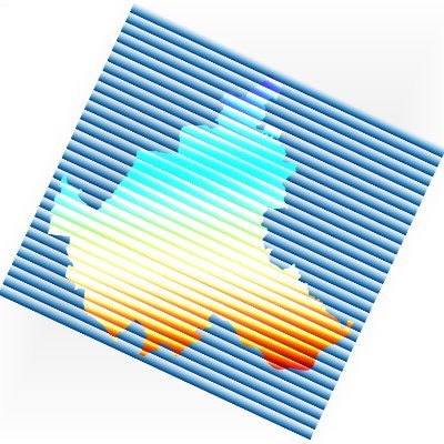
A Map🗺️ Showing Soil Texture Types of Africa Continent, Dataset is from (Hengl,T.,MacMillan,R.A,.2019) #Africa #EastAfrica #WestAfrica #SouthAfrica #NorthAfrica #Soil #geology #map #dataviz #gischat #geospatial #dataviz #qgis #b3d #Blender

Unsere aktuellen Regionalwirtschaftlichen Profile zeigen: Die #NRW-#Wirtschaft ist strukturell gut aufgestellt.💪 So haben die Unternehmen in NRW in den letzten zehn Jahren eine Million neue Stellen geschaffen. Alle neun Profile finden Sie hier. 👉nrwbank.de/regionale-wirt… #NRWBANK

Im @FOSS_Academy Web-Seminar im Juni geht es um den Aufbau einer #GDI mit Open-Source-Software Kostenloses einstündiges Web-Seminar 10.00 - 11.00 Uhr Jetzt schon anmelden! foss-academy.com/web-seminare/ #FOSSGIS #GIS #GEOSPATIAL #FOSS4G #OSGeo #GEOSPATIAL #OS

Im nächsten @FOSS_Academy Web-Seminar im Mai geht es um: #Mapbender Version 4 - Neuigkeiten aus dem Projekt 2. Mai 2024 Kostenloses einstündiges Web-Seminar 10.00 - 11.00 Uhr Jetzt schon anmelden! foss-academy.com/web-seminare/ #FOSSGIS #GIS #GEOSPATIAL #FOSS4G #OSGeo #GEOSPATIAL
Im Mai und Juni erwarten Sie @FOSS_Academy Online-Schulungen rund um #QGIS jeweils von 9:00-12:00 Uhr 28.-29.05. Einführung in QGIS 04.-07.06. QGIS für Fortgeschrittene 11.-14.06. QGIS Programmierung mit Python foss-academy.com/termine/ #FOSSGIS #GEOSPATIAL #OSGeo #FOSS4G
Entdecken Sie die Schulungen der @FOSS_Academy! Wir bieten Präsenz-, Online-Schulungen & Web-Seminare. Schulungen rund um #MapServer #PostGIS #PostgreSQL #QGIS #Python #Mapbender #GeoServer #MapProxy #OSM ... foss-academy.com/termine Jetzt buchen! #FOSSGIS #GIS #GEOSPATIAL #OSGeo
QGIS-Tipp: Objekte nach Zeichen teilen / Split features by character geoobserver.de/2024/04/qgis-t… via @spatialthoughts #qgis #switch2qgis #gistribe #gischat #fossgis #foss4g #OSGeo #spatial #geospatial #opensource #gis #geo #geoObserver pls RT


@WhereGroup_com Hier die wichtigste Kombination für #ArcGIS: Alt + F4
OD_LSA_Loader-Plugin: Hurra, immerhin ist es schon mal im QGIS Plugin Repository plugins.qgis.org/plugins/OD_LSA… 👍, nun fehlt es noch im QGIS Plugin Manager plugins.qgis.org/plugins/plugin… 🤷♂️ jemand eine Idee? #switch2qgis #qgis

The #foss4ge2024 porgram is out. @mapbender will be in Tartu in June with a workshop and a presentation. Meet @astroidex at the event. #mapbender #osgeo #foss4g
🎉Great news! 📚The complete FOSS4GE program is now available! Remember also to check out the academic track and workshop schedule.👀 ❗An early bird discount is available for those who register before May 10! 📌2024.europe.foss4g.org/schedule/talks/ #FOSS4GE2024 #FOSS4GE #FOSS4G
Die @FOSS_Academy bietet an jedem ersten Donnerstag im Monat ein kostenloses einstündiges Web-Seminar an. Im Mai geht es um #Mapbender Version 4 - Neuigkeiten aus dem Projekt 2. Mai 2024 10.00 - 11.00 Uhr Anmeldung foss-academy.com/web-seminare/ #fossgis @mapbender #osgeo #foss4g
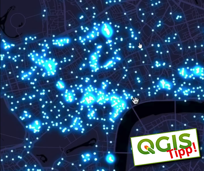
QGIS-Tipp: Die Glühwürmchen-Karte / QGIS tip: The firefly map geoobserver.de/2024/04/qgis-t… via @helenmakesmaps #qgis #switch2qgis #gistribe #DataViz #gischat #fossgis #foss4g #OSGeo #spatial #geospatial #opensource #mapping #gis #geo #geoObserver pls RT


OpenStreetMap.org is retiring OAuth 1.0a and HTTP Basic Auth on June 1st 2024. Are you developing software that uses one of these authentication methods to log in to the #openstreetmap website? Here's some guidance to help you switch to OAuth 2.0: blog.openstreetmap.org/2024/04/17/oau…


🎉Great news! 📚The complete FOSS4GE program is now available! Remember also to check out the academic track and workshop schedule.👀 ❗An early bird discount is available for those who register before May 10! 📌2024.europe.foss4g.org/schedule/talks/ #FOSS4GE2024 #FOSS4GE #FOSS4G
Trends for United States
You might like