Esri @Esri
Esri builds #ArcGIS, the leading location intelligence and spatial analytics software for mapping, 3D GIS, imagery, and geospatial app development. esri.com Joined September 2008-
Tweets21K
-
Followers193K
-
Following70K
-
Likes13K
Global brands are building sustainable futures with geospatial technology. Learn how: esri.social/2m6T50Rp6ng #Sustainability #GIS
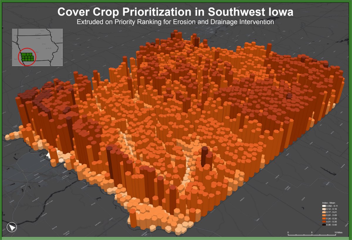
In agriculture, cover crops (typically legumes & cereal grains) are planted to restore the soil, prevent erosion, & reduce runoff. This 3D analysis helps farmers understand where cover crops are needed most. 🌱 🔸See the full map: esri.social/9zn150Rjb3N Author: Hannah Price
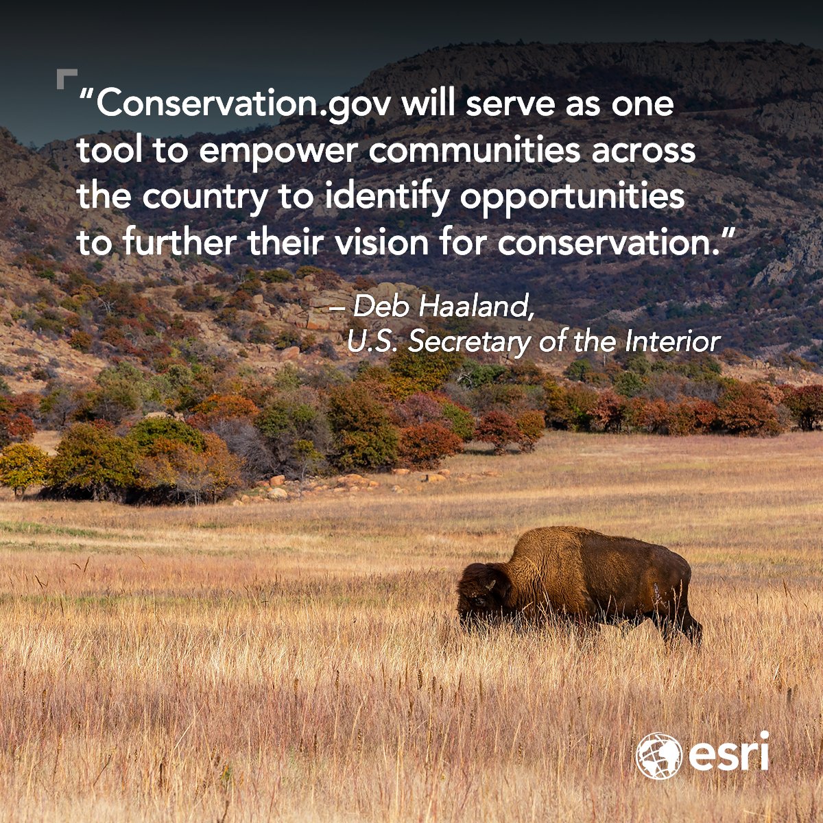
We're proud to support Conservation.gov, a new website from the @WhiteHouse that helps connect people with resources to conserve and restore U.S. lands, waters, and wildlife. conservation.gov #Conservation #30x30
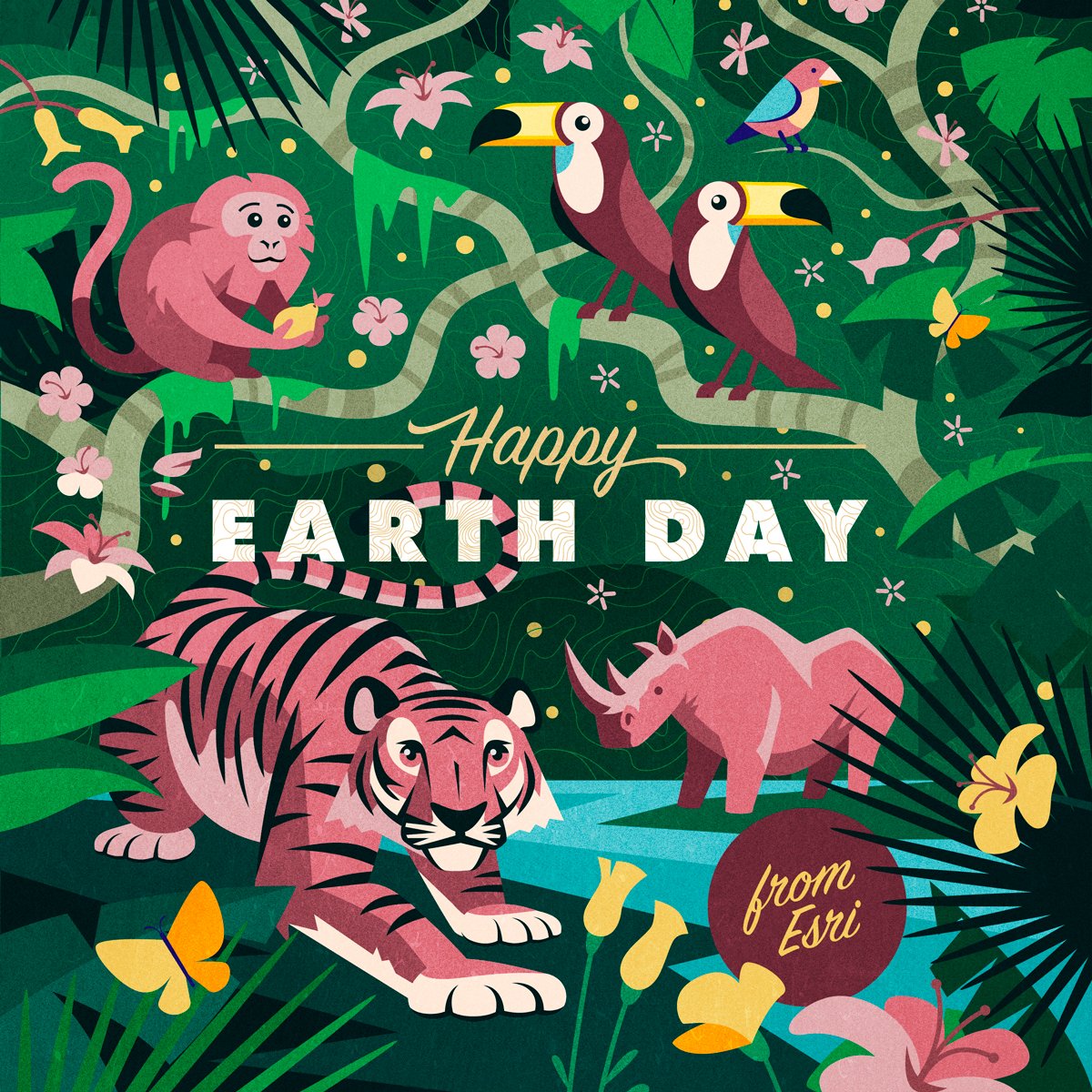
Happy Earth Day! 🌎 Let's celebrate the beauty of our planet and commit to protecting it for future generations. How are you using GIS to make a positive impact on Mother Earth today and every day? 💚 #EarthDay
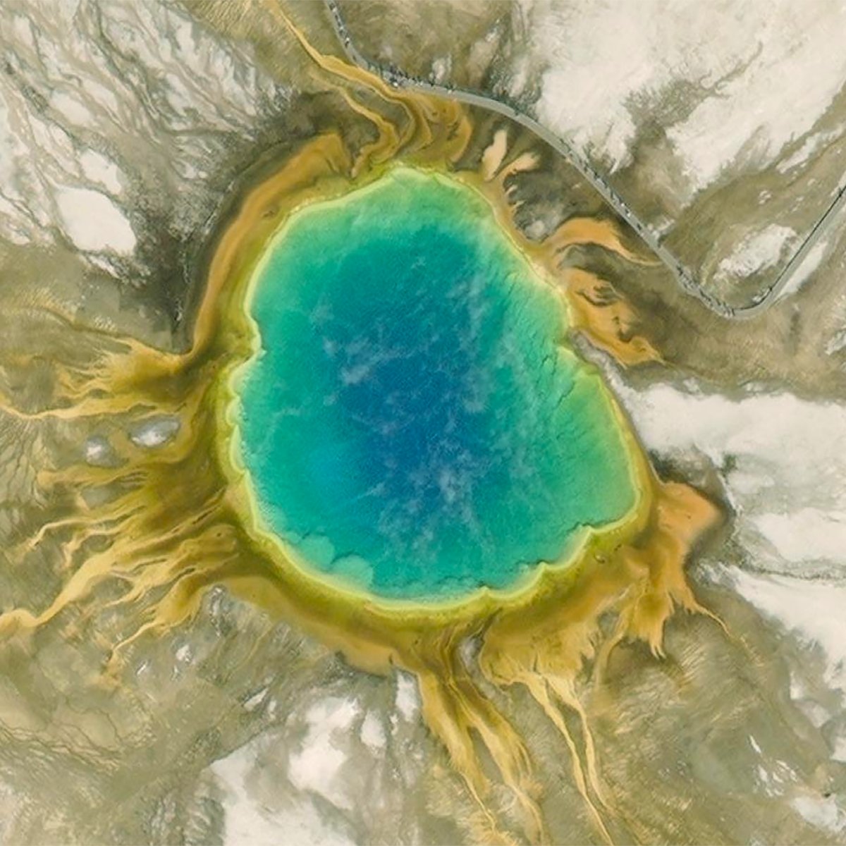
It's National Park Week! 🏞️ Can you guess the location of this giant rainbow hot spring? Hint: it's one of many thermal formations in this iconic national park. 🔸Find the answer and test your knowledge here: esri.social/JHHR50Rk3Pk #NationalParkWeek
Missed the deadline to sign up for our free Cartography. MOOC? Don't worry, registration has reopened! 🙌🏽 x.com/esritraining/s…
Missed the deadline to sign up for our free Cartography. MOOC? Don't worry, registration has reopened! 🙌🏽 x.com/esritraining/s…

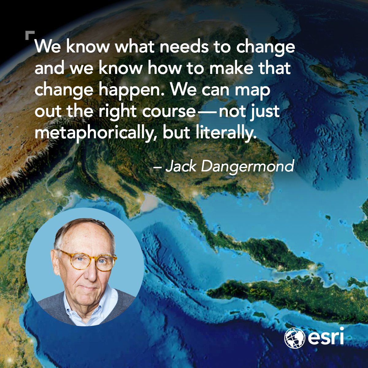
Since the first Earth Day in 1970, progress has been dramatic. But there's more to be done. Fortunately, we now have the tools to help us map a better future. Jack Dangermond shares his thoughts on creating the world we want to live in. esri.social/TE1U50RjtiN #EarthDay🌏 #GeoAI
Want to learn how to make a spinning globe? 🌏 Follow these easy steps using ArcGIS Online and ArcGIS Living Atlas. esri.social/eH5W50RgJKR #ArcGISOnline #LivingAtlas
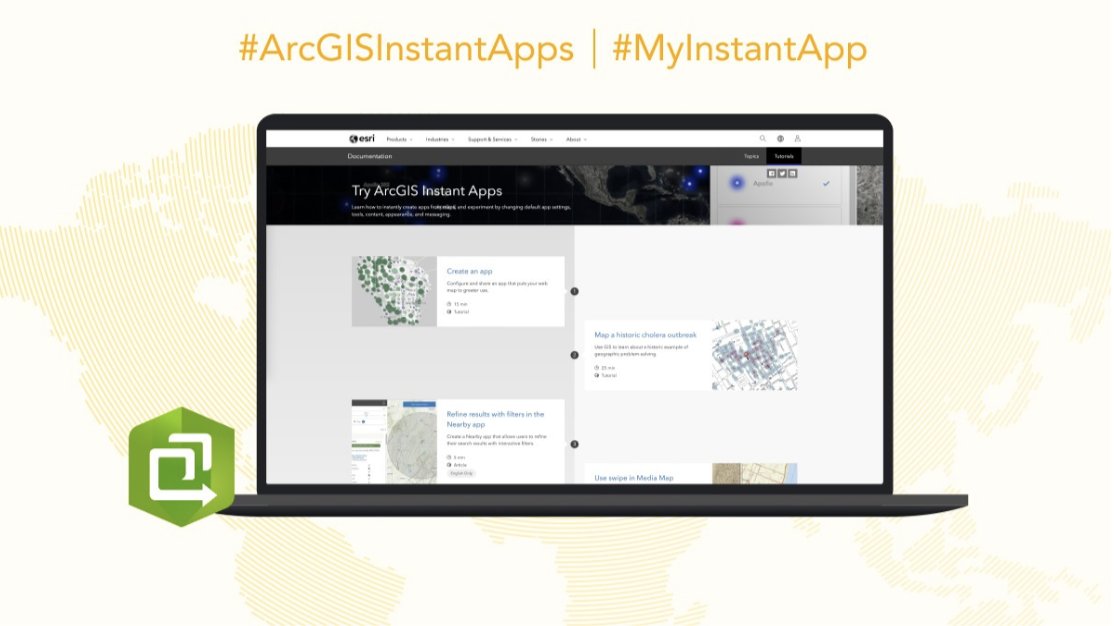
Check out this #ArcGISInstantApps tutorial series that teaches you how to instantly create apps from maps and experiment by changing default app settings, appearance, and messaging. Start tutorial: esri.social/29FU50QGZjN
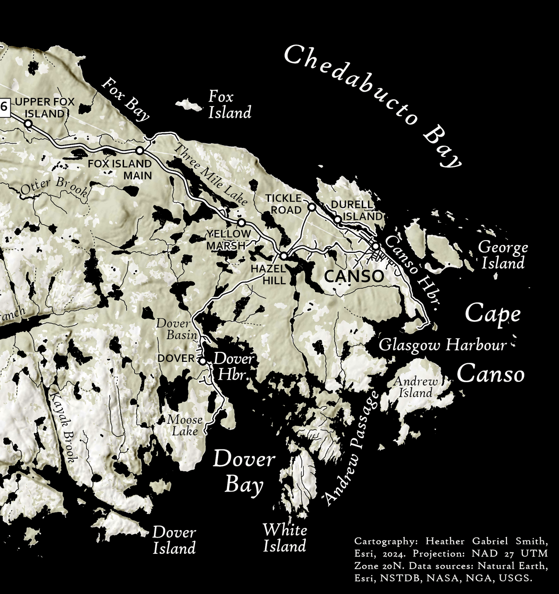
Cartographic conventions are common and typical ways that things are depicted on maps. 🗺️ Esri cartographer Heather Smith explains how they can help make your maps easier to understand. esri.social/pnky50R7Qlt #ArcGISPro #cartography
We are thrilled to announce that "An Interview with Jane Goodall" has been nominated for a Webby People's Voice Award! 🏆 Vote for this inspiring video in the Corporate Social Responsibility category by April 18. 🔹Vote: esri.social/eL4g50Rhhsy #GIS #Environment
Your favorite cartography course is back! 🗺️ Learn from experts and make beautiful maps using #ArcGISPro. Registration closes on April 17. 🔸Register: esri.social/8Q8450R8Pn6

Illuminate your maps! ✨ Learn how to make point features in @ArcGISOnline look like they’re illuminating your map. esri.social/MPSH50R8TJV #Cartography #ArcGIS
It’s been nearly 18 years since Nigeria conducted an official census. For the first time in its history, the country plans to use digital tools to prepare an accurate population count. esri.social/8wqQ50RbUi7 #Census #GIS

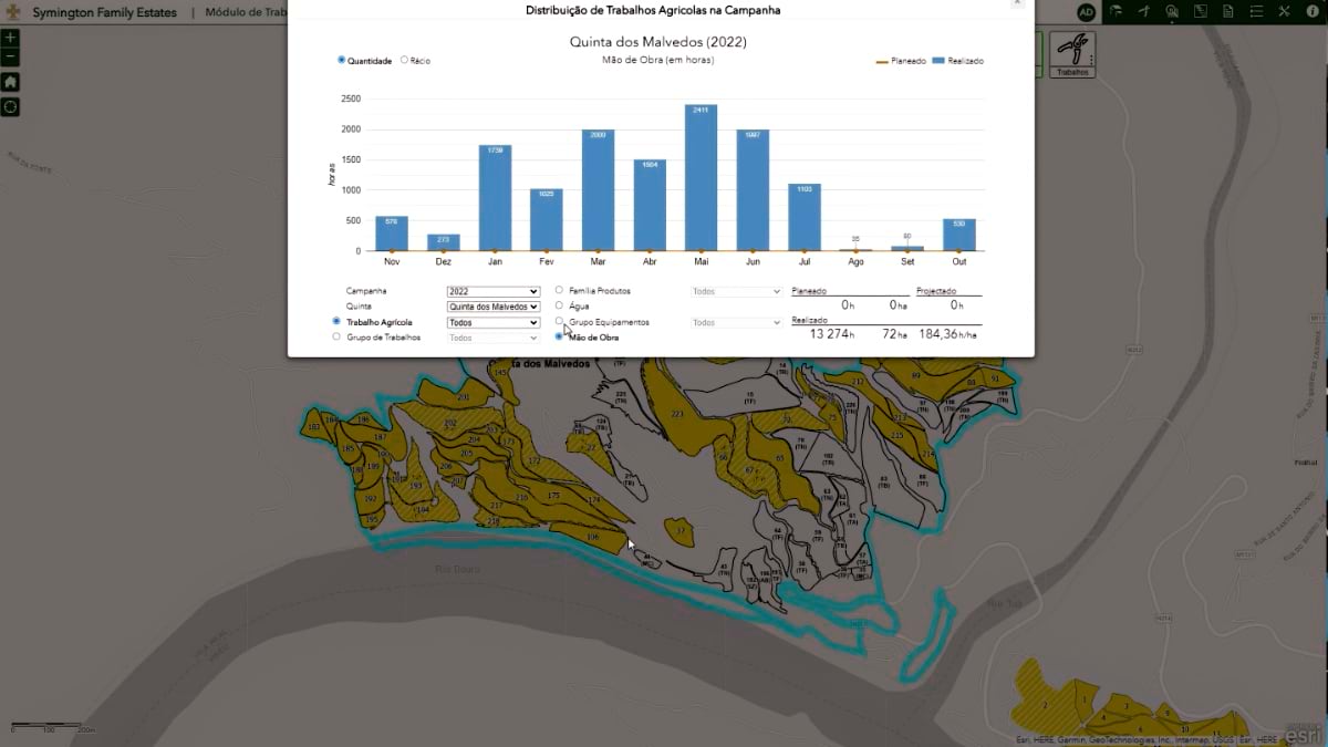
Portuguese vintner @SymingtonFamily achieves the quality of its award-winning port wines using a geographic approach. Over the years, operations have become more mechanized, but always with a focus on outcome, applying science to improve the end product. esri.social/9NI850Rbs4x

Maximize your mapping potential. 🗺️ Here are 10 ways to get the most out of ArcGIS Living Atlas. esri.social/lcev50R8TyW #Mapping #LivingAtlas
Are you in the path of totality or just getting a glimpse? A total solar eclipse will darken parts of North America today as the Moon covers the Sun. 🌕🌑 Find out the timing, type of eclipse, and tips for better viewing. 🕶️ esri.social/eR6k50R9EeG #Eclipse2024 #StoryMaps
Not your ordinary job— During the 2017 #eclipse, bats emerged and prairie dogs chattered. This @nationalparkservice scientist was there to record it. Meet Sharolyn Anderson and discover the science behind your nighttime view: esri.social/3m5M50R6vk8 #GIS #DarkSkies #idsw2024

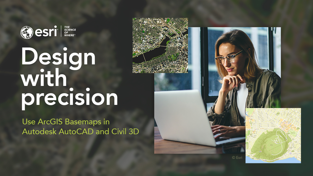
We're excited to collaborate with @autodesk to integrate ArcGIS Basemaps into Autodesk AutoCAD and Civil 3D - bringing rich, authoritative geospatial data and mapping capabilities to #AEC projects. 🔸Learn more: esri.social/Ks9S50R7ZX2 #Civil3D2025
It's never too early to start planning your summer activities! 😉Join your fellow geogeeks at this year's @EsriUC in San Diego, California. 🔹Register: ow.ly/Iisc50R5amP #EsriUC2024


🥔🗺️ ᴘᴏᴋ.. @pokateo_maps
25K Followers 3K Following 👋🏻 I'm Kate ᵉᵃᵗᵉʳ ᵒᶠ ᵖᵒᵗᵃᵗᵒᵉˢ ᵃⁿᵈ ᵐᵃᵏᵉʳ ᵒᶠ ᵐᵃᵖˢ 🌐 I make #geospatial & #GIS (more) fun by sharing #mappymeme s & #maptastic themes. Hosts #GISchat. ᵛᶦᵉʷˢᵐᶦⁿᵉ
Qiusheng Wu @giswqs
38K Followers 5K Following Associate Professor @UTKGeography | @Amazon Visiting Academic | Senior Reseach Fellow @UNUINWEH | #EarthEngine GDE | Talk about #opensource #geospatial #dataviz
John Nelson @John_M_Nelson
24K Followers 97 Following Maker of maps. Talker of making of maps. Purveyor of gumption. Mitten State. I make map videos now? https://t.co/lTYF0UBzhp (views mine, etc.)
Dr. Dawn Wright + @de.. @deepseadawn
23K Followers 958 Following Aquanaut + Chief Scientist of @Esri + @OregonState GIS/oceans professor, cyclist, 1st Black diver to #ChallengerDeep, builds w/LEGO, raised in Hawaii.
josephkerski @josephkerski
14K Followers 2K Following Geography, geo-geekiness, STEM, ed tech, space, place, geographic information systems (GIS), GPS, outdoor education 365 days a year.
Esri Training @EsriTraining
33K Followers 1K Following Advancing geospatial capabilities of individuals, teams, and organizations is our mission and our passion.
michael GOULD (@mgoul.. @0mgould
11K Followers 3K Following GIS professor and Global Education Manager at Esri (opinions my own). #travel #mountainbike #internationalDev #GIS #Spain #sarcasm
Remote Sensing MDPI @RemoteSens_MDPI
17K Followers 980 Following No. 1 #remotesensing #openaccess journal in Remote Sensing Category in #WoS, published by @MDPIOpenAccess; IF 2022 5.0; CiteScore 2021 7.9; #mdpiremotesensing
منصة نظم ال�.. @gis_eductation
10K Followers 5K Following نهتم بنظم المعلومات الجغرافية | GIS | نشر المعرفة الخاصة ب GIS | مؤتمرات | ورش العمل | كتب GIS | المنتديات | GPS | #اعلانات_دورات_GIS #اعلانات_كتب_GIS
Wanmei L 🌎🛰️ @MapsbyW
3K Followers 303 Following Science Data Visualizer at NASA 🌎 🛰️ 🗺️ | UCLA Alumni 🎓 | Visual Storyteller 📚 | Cartographer 🧭
MappingGIS 🚀🌍 @MappingGIS
23K Followers 308 Following Formación que impulsa tu perfil GIS. Cursos online de #QGIS #R #ArcGIS #PostGIS #webmapping #python #GeoServer #OpenLayers #Leaflet #gisenlanube #teledeteccion
Joshua Stevens @jscarto
15K Followers 1K Following Cartographic Editor @mapsdotcom & Content Strategy @Esri. Prev: DataViz Lead @NASAEarth, @NSF PhD Fellow @PSUGeography. Dad stuff everywhere else. Views my own.
Carl Churchill @Cchurchili
6K Followers 2K Following Cartographer Graphics Reporter with @WSJ [email protected] https://t.co/F34A0XzB3P… / https://t.co/4EtlArbMQu
Esri GIS Education @GISEd
20K Followers 725 Following Esri GIS Education - news, curriculum, software, tools and more
NASA Landsat @NASA_Landsat
80K Followers 470 Following The NASA/USGS Landsat series of Earth-observing satellites has monitored our planet for 50 years. Verification: https://t.co/4p9BhINXeQ
Helen McKenzie @helenmakesmaps
12K Followers 1K Following Data & geospatial advocate, content creator & all around map geek @CARTO🌍🌐🗺 Likes: cheese on beans on toast, sitting, otters. Views mine. she/her.
Topi Tjukanov @tjukanov
21K Followers 2K Following Makes maps. Works at @Mapbox. Started #30DayMapChallenge.
USGS Landsat @USGSLandsat
37K Followers 214 Following Official USGS account for the Landsat Program - a series of Earth-observing satellites co-managed by @USGS & @NASA. Imaging the Earth since 1972.📡🛰️
ʟᴀɴᴅ sᴜʀᴠ�.. @LandSurveyorsU
9K Followers 589 Following ʟᴀɴᴅsᴜʀᴠᴇʏᴏʀsᴜɴɪᴛᴇᴅ.ᴄᴏᴍ #ʟᴀɴᴅsᴜʀᴠᴇʏᴏʀs ᴛᴀᴘ ɪɴᴛᴏ ᴛʜᴇ #sᴜʀᴠᴇʏɪɴɢ ᴇxᴘᴇʀɪᴇɴᴄᴇ ᴏғ ᴏᴠᴇʀ 21ᴋ #sᴜʀᴠᴇʏᴏʀs ɪɴsɪᴅᴇ ʟᴀɴᴅ sᴜʀᴠᴇʏᴏʀs ᴜɴɪᴛᴇᴅ ᴄᴏᴍᴍᴜɴɪᴛʏ. ᴊᴏʙs, sᴜᴘᴘᴏʀᴛ & ᴍᴏʀᴇ ✊
fosstodon.org/@klaska.. @klaskarlsson
8K Followers 87 Following SwAF working with geosupport in the field and in systems developement. Here I mostly write about things that interest me when I'm not at work. Open Sources.
IamWhALeS®️ @IamWhALeS_
165 Followers 538 Following #Welcome to my page!! Surveyor in the making👷♂️| Geomatician | GIS Expert | AutoCAD Expert | Forex and Crypto Enthusiasts | Proudly Sagittarius ♐️ 📆
Ryan @ThaiFoodLuvr
939 Followers 925 Following #BTC | Arizonan | Builder | Veteran | Security Architect | Off-gridder
timakin @timakin
1K Followers 3K Following Exec. Dir. Marketing @UCDavismba | Master Storyteller | Softball Diehard | Adventure Seeker | @UCBerkeley Grad | @SantaBarbara Native | https://t.co/HxJtdf9gzp
PEYTORILL @peytorill
6 Followers 60 Following https://t.co/bwEPm71ncC | https://t.co/3uLX4Sisdw Synoptic, Cartographic, Oriented.
youness @youness38382651
17 Followers 410 Following
SOUTĚŽ CHYTRÁ MĚS.. @MestaChytra
26 Followers 213 Following Soutěž CHYTRÁ MĚSTA 2024 je klíčovou soutěží svého druhu v Česku. Jejím organizátorem je Smart City Innovations Institut, z.ú. @sci_smartcity
Dawood Ashrafzoy @DAshrafzoy
84 Followers 1K Following
Austin Butler @authbu
1 Followers 34 Following
maro @marekhaltoff
5 Followers 6 Following
Sudheer Sutar @SudheerSutar
4 Followers 76 Following
Mustafa Enes Kul @MustafaEnesKul1
3 Followers 228 Following
John @JKsurveyinc
0 Followers 6 Following
DANIEL MIHALACHE @DANIELM60729703
642 Followers 6K Following

Society of Geoinforma.. @Sge__official
3 Followers 8 Following The Geoinformatics Engineers page CEG, Anna University Symposiums: Geo Horizon|Celestia https://t.co/TLtR6impCa
Zulay Mora Rivas @Rivas1Mora
0 Followers 2 Following
success Story @storyofmillions
8 Followers 806 Following Our goal is to empower you through millionaires stories, guiding you towards success. Share your Story !
FRANCIS OTIA @francis_otia
1 Followers 46 Following Technologist, Surveying and Geo-Informatics! For all Land Related issues, contact: 08161965054
Henry Miranda @HenryMi77784157
7 Followers 224 Following
Ahmed Hamada Hassan @3hmed_7am3da
0 Followers 5 Following


Colored People's Time.. @cpt_inc
5 Followers 40 Following devoted to enriching the lives of all black people #CPT
John J @John341J
12 Followers 12 Following
محمد بن أحم�.. @mohamedpt9
12 Followers 796 Following الحمد لله اللهم ارحمني وسددني واهدني استغفر الله
Kalani Williams @iguanaonarock
111 Followers 446 Following Invertebrate Zoology @AMNH and PhD candidate at Fordham University, @smithcollege alumn, she/her
Subhashini Pillay @ab4685145045441
0 Followers 9 Following
Alvaro Manrique @dechanchoypollo
220 Followers 326 Following Hydrographic Surveyor (ICA/IFG/IHO CAT- A & B). Fanático de Universitario de deportes Ⓤ. Bodyboarding
MitchelleBnTz {X} & X.. @MitchelleBanti1
176 Followers 2K Following
VitaliiTSK @TskVitalii
3 Followers 53 Following
Shitho @Shitho116955
40 Followers 2K Following
✸ @perplexiingly
0 Followers 38 Following
Gülçin Yıldırım .. @apatheticmagpie
5K Followers 4K Following Staff Eng @EDBPostgres, 🎙️@postgrespodcast, MSc Computer & Systems Eng @TallinnTech, BSc Applied Maths @YildizEdu, @kadinyazilimci, @PrahaPostgreSQL
mapsmadesimple @mineralgis
50 Followers 69 Following
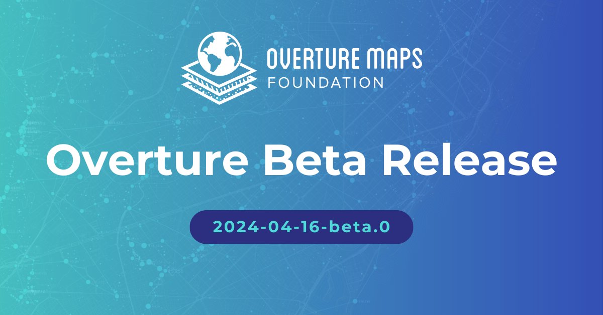
Overture Maps Foundat.. @OvertureMaps
3K Followers 21 Following Collaborative effort to develop interoperable open map data for mapping services worldwide | @linuxfoundation open source project

Ademola @king_alomeda
97 Followers 123 Following Developer || HTML || CSS || Javascript || Bootstrap||Jquery || M sc (G.I.S and Remote sensing- in view). https://t.co/YfmA6vBPPn (Build in progress)
Alejandro Samayoa @alejo_sama
69 Followers 462 Following
Mason @_geoMSON
0 Followers 14 Following
Mr B. Evans @mrevansgeo
4 Followers 40 Following
Will - TornadoTRX @tornadotrx
702 Followers 338 Following storm chaser and weather youtuber who edits way too much.
❄️ Gas Chamber❄.. @ProjektXpand
2K Followers 1K Following •¥ Futurism | Soon Coming … @Brikkka_Px • New World Order • Personal & Professional Integrity ¥•
MA|Gis🗺 @MAN0l022
0 Followers 48 Following طالبة بكالوريوس بجامعة الملك عبدالعزيز.. تخصص نظم المعلومات الجغرافية🗺
K @Annf5F8iMpaqB89
0 Followers 31 Following
do11_mc @do11_mc5
13 Followers 88 Following
محمد عوض مح�.. @mhmdawadn209
1 Followers 81 Following
Cynthia Gonzalez @TruthbHoldnBold
2 Followers 41 Following
Dr. Hussein Kasim @Husseinkasim
3K Followers 226 Following Chief of Cabinet of SRS,PhD in Public policy. Interests: politics, state building, and development. Retweets are not endorsements.
🥔🗺️ ᴘᴏᴋ.. @pokateo_maps
25K Followers 3K Following 👋🏻 I'm Kate ᵉᵃᵗᵉʳ ᵒᶠ ᵖᵒᵗᵃᵗᵒᵉˢ ᵃⁿᵈ ᵐᵃᵏᵉʳ ᵒᶠ ᵐᵃᵖˢ 🌐 I make #geospatial & #GIS (more) fun by sharing #mappymeme s & #maptastic themes. Hosts #GISchat. ᵛᶦᵉʷˢᵐᶦⁿᵉ
John Nelson @John_M_Nelson
24K Followers 97 Following Maker of maps. Talker of making of maps. Purveyor of gumption. Mitten State. I make map videos now? https://t.co/lTYF0UBzhp (views mine, etc.)
Dr. Dawn Wright + @de.. @deepseadawn
23K Followers 958 Following Aquanaut + Chief Scientist of @Esri + @OregonState GIS/oceans professor, cyclist, 1st Black diver to #ChallengerDeep, builds w/LEGO, raised in Hawaii.
josephkerski @josephkerski
14K Followers 2K Following Geography, geo-geekiness, STEM, ed tech, space, place, geographic information systems (GIS), GPS, outdoor education 365 days a year.
Esri Training @EsriTraining
33K Followers 1K Following Advancing geospatial capabilities of individuals, teams, and organizations is our mission and our passion.
michael GOULD (@mgoul.. @0mgould
11K Followers 3K Following GIS professor and Global Education Manager at Esri (opinions my own). #travel #mountainbike #internationalDev #GIS #Spain #sarcasm
Remote Sensing MDPI @RemoteSens_MDPI
17K Followers 980 Following No. 1 #remotesensing #openaccess journal in Remote Sensing Category in #WoS, published by @MDPIOpenAccess; IF 2022 5.0; CiteScore 2021 7.9; #mdpiremotesensing
Sarah Bell @sarahbellmaps
11K Followers 453 Following Cartographer, Dataviz, Geospatial scientist, & cartography author always pursuing creative visualization @esri You'll find me either rock climbing or map-making
MappingGIS 🚀🌍 @MappingGIS
23K Followers 308 Following Formación que impulsa tu perfil GIS. Cursos online de #QGIS #R #ArcGIS #PostGIS #webmapping #python #GeoServer #OpenLayers #Leaflet #gisenlanube #teledeteccion
Joshua Stevens @jscarto
15K Followers 1K Following Cartographic Editor @mapsdotcom & Content Strategy @Esri. Prev: DataViz Lead @NASAEarth, @NSF PhD Fellow @PSUGeography. Dad stuff everywhere else. Views my own.
Esri GIS Education @GISEd
20K Followers 725 Following Esri GIS Education - news, curriculum, software, tools and more
NASA Landsat @NASA_Landsat
80K Followers 470 Following The NASA/USGS Landsat series of Earth-observing satellites has monitored our planet for 50 years. Verification: https://t.co/4p9BhINXeQ
Helen McKenzie @helenmakesmaps
12K Followers 1K Following Data & geospatial advocate, content creator & all around map geek @CARTO🌍🌐🗺 Likes: cheese on beans on toast, sitting, otters. Views mine. she/her.
USGS Landsat @USGSLandsat
37K Followers 214 Following Official USGS account for the Landsat Program - a series of Earth-observing satellites co-managed by @USGS & @NASA. Imaging the Earth since 1972.📡🛰️
Daniel P. Huffman @pinakographos
11K Followers 84 Following An arboreal, poly, gender non-participant mapmaker. You can support my art & teaching at https://t.co/FzQRVe3aY8. Also: https://t.co/i6qDLfbARo & @AlphaCentQuotes.
fosstodon.org/@klaska.. @klaskarlsson
8K Followers 87 Following SwAF working with geosupport in the field and in systems developement. Here I mostly write about things that interest me when I'm not at work. Open Sources.
د. نواف العت.. @Alotaibi_Nawaf3
10K Followers 79 Following مدرب، مستشار و مؤلف في: GIS & حل المشكلات. | الماستر والدكتوراه في #نظم_المعلومات_الجغرافية/ @UniversityLeeds 🎯
YouthMappers @youthmappers
10K Followers 1K Following Official handle of the global network of student-led mapping chapters. https://t.co/lpjvoBb6QL Follow our sister account @LetGirlsMap! #OpenStreetMap #YouthMappers
ir. CHEPKOCHEI, Lucy @lucychepkosgei
8K Followers 3K Following | SDGs | Geospatial | Remote Sensing | GIS Distinguished Contribution Award🎖 | Women in STEM Award 🏆 | Opinions are personal | RT/Follow are not endorsement |
QGIS @qgis
67K Followers 72 Following Official account of QGIS - the user friendly Open Source Geographic Information System
Quiet Professionals, .. @QuietProLLC
113 Followers 159 Following Defense contractor providing professional services in Operational Mission Support, Global Intelligence Support Services, Cloud Services, and more!

ArcGIS Urban @ArcGISUrban
1K Followers 40 Following ArcGIS Urban is a web-based 3D planning experience that enables communities to make smart decisions for urban development #urbanplanning #3D #SmartCities
Impact Observatory @ImpactObserv
1K Followers 100 Following Impact Observatory helps governments, industry, and finance understand our changing world using AI+space data. Now @impactobservatory on Instagram + Threads!
ICEYE @ICEYEfi
53K Followers 189 Following We manufacture and operate the world's largest SAR satellite constellation 🛰️
Dr. Paulette Brown Hi.. @mygoldenstate
1K Followers 1K Following latest: co-founder @EquimediaAdvsrs | 2x @jskstanford | service: @rebuild_local @irvinefdn @cal_press @inlandempirecf @ampress | always: @blackvoicenews
Matidor.com @matidor_com
147 Followers 184 Following Project management on a live map for field services and the energy sector.
Orbital Insight @orbital_insight
7K Followers 342 Following Orbital Insight helps organizations understand what’s happening on and to the Earth so they can turn changes into new opportunities.
Woodwell Arctic @woodwellarctic
772 Followers 600 Following ❄ Home of #PermafrostPathways #Arctic team @WoodwellClimate exploring the changing North and what that means for Arctic communities and the rest of the planet.
Integrity Management @IntegrityMC
272 Followers 192 Following An award-winning provider of acquisition, program management, and financial support services to the public sector. Visit us to see how we can make an impact!

Tom Williams @TomWilliamsUX
7 Followers 86 Following UX Designer @ Trimble. NFT Community Member. Mainly tagging companies and whining about my experiences.
Sucio McMahon @JulioJarOfMio
53 Followers 87 Following
FootPrint Coalition @fp_coalition
52K Followers 37 Following Welcome to @RobertDowneyJr’s #FootPrintCoalition, let’s clean up the planet!🌎 | IG: @ officialfootprintcoalition
Mapping Prejudice @MapPrejudice
3K Followers 689 Following Visualizing the hidden histories of race and privilege in the built environment.
Amazon Web Services @AWS
13K Followers 1 Following For all the latest news and information about AWS head to @AWSCloud. For support, go to @AWSSupport
Sandra M. Turner @SandMTurner
452 Followers 398 Following National Geographic Certified Educator & Explorer | Advancing Global Climate Change & Ocean Education Where it Matters Most. | Somewhere On an Island.
Fulcrum @fulcrumapp
3K Followers 2K Following Fulcrum is an industrial-strength, geospatially focused field data collection and process management platform. Please visit us at https://t.co/Xps0JPrqvG.
AirspaceLink @AirspaceLink
668 Followers 317 Following Enabling the safe integration of drones into the national airspace & communities through digital infrastructure, strategic partnerships & thought leadership.
Durga Nanda Yadav @yadavdurga192
331 Followers 3K Following NRCA @NTNCNepal | Passionate about conservation| Wildlife| Forestry | Ecology| Human-wildlife Conflict |GIS 🐅🐆🦏🐘🐻
Maps, Charts, and Dat.. @MapsChartsData
203 Followers 961 Following Geospatial data analyst interested in creating, sharing, learning, and teaching different ways to analyze data.
Pedro_Henriques @PedroHe19693833
103 Followers 531 Following GIS Analyst, Town Planner, Heritage Specialist Independent family traveller - Travel Blogger @espiritviajante #gis #geography #urbanplanning #maps #cartography
Consortech @Consortech
79 Followers 85 Following Consortech is a consulting firm dedicated to generating value through geospatial performance by leveraging the complementarity of FME and ArcGIS.
Irena Gorski-Steiner,.. @IrenaGSteiner
581 Followers 1K Following Hydrogeologist turned environmental epidemiologist at nexus of mental health, EJ, built environment, & climate change | ORISE Fellow at #OCCHE
Sierra Leone Institut.. @SGeoscientists
814 Followers 957 Following SLIG is a registered professional organization in Sierra Leone to seek the career interests of Geoscientists and promote the status and perception of geoscience
Frank Romo @jet_lifers
4K Followers 4K Following Entrepreneur, Creator, & Community leader focused on Social Impact. GIS for Good: @romo_gis & Art & Wellness: @lov3_theory

Aydan Scott @australianaydan
118 Followers 530 Following Half Australian, B.A. in Geography with a Sustainability Minor, CSUN Graduate, Massive Nerd, looking to become a Geographic Information Science Professonal!
Hamad Hassan Moustafa @DrHamadHassanM1
17 Followers 116 Following التعلم بلا تفكير مضيعةٌ للوقت. أما التفكير بلا علم, شيء خطير.

Lauren Gardner @TexasDownUnder
5K Followers 254 Following
Terex Corporation @TerexCorp
13K Followers 185 Following We are a global manufacturer of lifting and material processing products and services. Major Terex brands include #Terex, @GenieLift and @Powerscreen.
NorthStar of GIS: Peo.. @gisNorthStar
847 Followers 563 Following Increasing #BlackRepresentation and #RacialEquity in #geography, #GIS, and #Geospatial #BlackInGIS #MelanatedAndMapping #MelanatingGeography
Enel Green Power @enelgreenpower
8K Followers 341 Following We produce and manage energy from the wind, sun, water, and earth. We are people who work to create a more sustainable world. We are part of Enel Group.
Louisiana DOTD @La_DOTD
26K Followers 737 Following The official account of the Louisiana Department of Transportation and Development.
BlackGirlsMapp @BlackGirlsMapp
1K Followers 103 Following Celebrating & connecting marginalized communities; using GIS to investigate social issues & empower change. Opinions may not reflect Esri's views.
AssetAlly @AssetAlly
30 Followers 194 Following Integrate your community assets into a single, digital tool that empowers your staff to be more productive with access to accurate infrastructure data.
Dolores Huerta Founda.. @DoloresHuertaFD
6K Followers 367 Following Organizes at the grassroots level by engaging and developing natural leaders for community organizing, civic engagement & policy advocacy.
Unity for Games @unitygames
475K Followers 1K Following The leading platform for creating immersive and interactive 2D, 3D, and VR games on 20+ platforms | Part of the @unity solutions portfolio 🚀 🎮
Unreal Engine @UnrealEngine
591K Followers 11K Following Unreal Engine is the world’s most open and advanced real-time 3D tool. Learn more about how to get started with #UE5: https://t.co/UoseIQW5lV
Petunia Pig @KellyGerrow
294 Followers 147 Following
Béatrice Leydier �.. @BeaLeydier
3K Followers 4K Following conseillère des 🇫🇷 de l'étranger à DC 🇺🇲, nerd @gui2de_GU, team croissance 🥐 & chocolatine. unfortunately no one is responsible for my tweets
CME Programme @CME_Prog
630 Followers 172 Following Commonwealth Marine Economies Programme: a UK Government scientific partnership enabling marine economies. @foreignoffice @CefasGovUK @UKHO @NOCNews

Jan Kristian Jensen @LtGlahn
337 Followers 528 Following Geodatanerd, gammal meteorolog og OGC evangelist. Nasjonal vegdatabank.
Jeff Kearns @jeffkearns
5K Followers 5K Following International Monetary Fund senior communications officer
Trelynd Bradley @trelynd
2K Followers 2K Following California Business & Economic Development (@CAGOBiz @CAGovernor); MBA Candidate (@UCLAAnderson); Alum (@CapFellowsCSUS, @UCRiverside); Views = Own
Ashutosh Upadhyay �.. @iashutoshu
820 Followers 800 Following #iamabotanist | Researcher | Plant biology | NRM | Nature and Wildlife photographer and an avid traveller.
🌊 GIVE US A WAVE! 🌊 Meet Dr Dawn Wright, an esteemed member of our Strategic Advisory Group. Dawn is Chief #Scientist of the Environmental Systems Research Institute (@Esri), a world-leading #geographic information software and data science company.

🌍 Overture Maps announces the Beta release of our global open map dataset, moving us closer to production-ready data for diverse applications. Learn more about the release and join the beta testing: hubs.la/Q02s_zQj0 #Openmapdata #opendata #overturemaps

Check out Melissa's #GIS team's StoryMap on the recent 4.8 magnitude earthquake in New Jersey on April 5th. Discover the impact on states, counties, zip codes, land parcels, and addresses near the epicenter. Powered by @Esri - view here: i.melissa.com/3UtSYpK #EsriPartner
It's almost #EarthDay! 🌎🥳 Read inspiring #conservation stories about the planet and its champions: esri.social/SAr350RkciQ 📷: @Esri's #StoryMaps team

Check out this NEW website from @WhiteHouse! We're excited to use these new resources to help advance @30x30CA and cheer on our partners in conservation nationwide 🎉 conservation.gov

Our Administration is launching conservation.gov – a new website to help connect people with information, tools, resources, and opportunities to support land and water conservation projects in communities across the country.

Our Administration is launching conservation.gov – a new website to help connect people with information, tools, resources, and opportunities to support land and water conservation projects in communities across the country.

The New hub will connect communities with resources and funding available through @POTUS Investing in America agenda.

Since I took office, my Administration has protected 41 million acres of America's natural wonders. Head to Conservation.gov to get the latest information, tools, resources, and opportunities to support land and water conservation projects in your neighborhood.
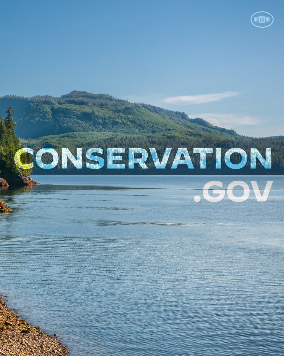
Biden-Harris Administration launches Conservation.gov, showcasing and supporting the rapid acceleration of locally led efforts to conserve, protect and restore lands and waters across America.

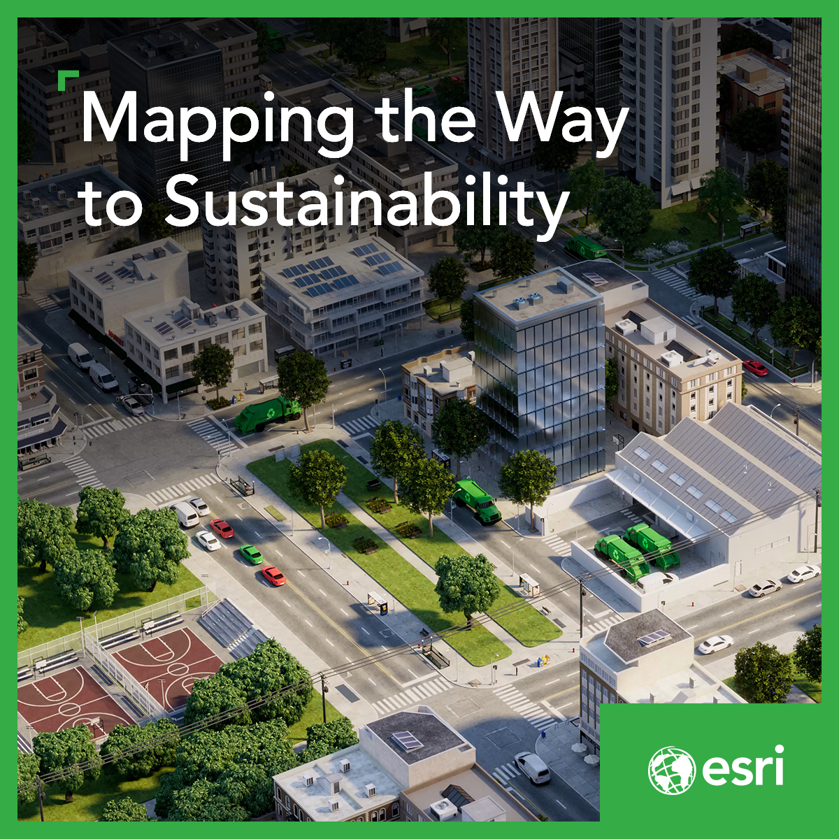
#MSPartner @Esri is making agriculture part of the solution to climate change. 🌎 Learn how their ArcGIS technology, run on Microsoft Azure, helps farmers transform decision-making with spatial insights and mapping: msft.it/6017c7mDT #Manufacturing #HM24

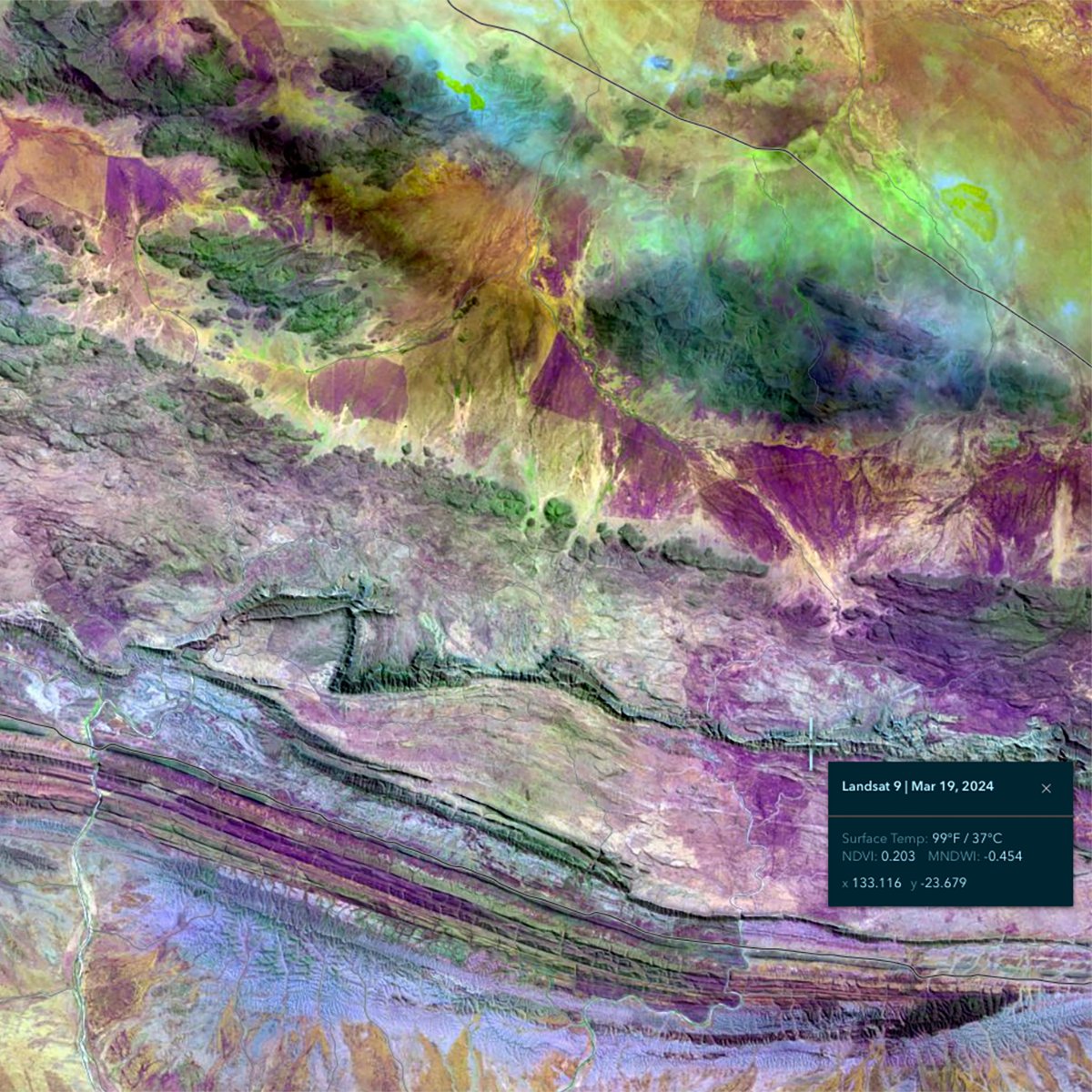
The Landsat program has acquired more than 10 million images of our planet, going back half a century. #LandsatExplorer from @Esri provides immediate access to four decades of Landsat data. It includes natural color, vegetation indices, surface temperature, and more. Learn more…
👏 Congratulations to the amazing MS-GIS student Fernanda Argueta for being selected for the UMD @Esri Innovation Program Student of the Year 🎉🥳 Read more: go.umd.edu/esri-innovatio…


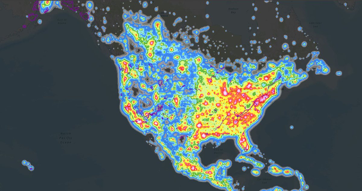
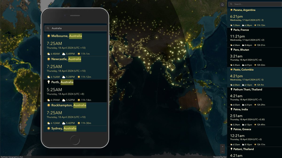
Updated my #WorldClock #Dashboard incorporating @John_M_Nelson's #LightSource trick🪄✨ It's now mobile-friendly too! 🖥️📲Check it out👉 arcg.is/0iHbvW #ArcGISDashbards #ArcGISOnline #ArcGISArcade @Esri

We are beyond grateful for Platinum Sponsor, @Esri, for their generosity. Thank you for your contribution to making our meeting the best event possible! esri.com/en-us/home


📸 The ROK team at last week's #EsriSEUC2024📸 It was great to be back in Palm Beach for the @Esri Southeastern User Conference ? Did you attend? Let us know abut your favorite session in the comments⬇️ #GIS #Cloud


Join Cindy Elliott from @Esri, and Tom Raftery on Industry Insights by SAP discussing how Esri is partnering with SAP to provide L+O (Location + Operations) data to help businesses understand their global impact and enhance sustainability. Full podcast: hubs.ly/Q02rZtyH0

It's...lit?
Illuminate your maps! ✨ Learn how to make point features in @ArcGISOnline look like they’re illuminating your map. esri.social/MPSH50R8TJV #Cartography #ArcGIS

Join Cindy Elliott from @Esri, and Tom Raftery on Industry Insights by SAP discussing how Esri is partnering with SAP to provide L+O (Location + Operations) data to help businesses understand their global impact and enhance sustainability. Full podcast: hubs.ly/Q02rZhLL0

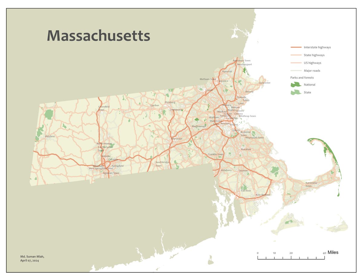
Excited to share my latest creation! 🗺️ Thanks to @Esri's free Cartography course, I've crafted this Map of Massachusetts. Thrilled to have had access to the latest ArcGIS Pro license during the course. #CartoMOOC #Mapping #ArcGISPro #Massachusetts

@MatthewHMalone 😆 I really thought this would be me with @Esri ArcMap until the end! But @ArcGISPro sold me with the improved cloud integration.
Trends for United States
You might like