Search results for #geospatial

At IQGeo we’re helping broadband and utility network operators achieve digital equity and create the net-zero economy of the future. Together with our customers and partners, we are “Building Better Networks”. Learn what makes IQGeo different: hubs.ly/Q02v8DPF0 #Geospatial

#jobingis: WFP is hiring a Geospatial information Specialist 📍: #Kyiv , #Ukraine️ Apply here 👉 : jobingis.com/jobs/geospatia… #Jobs #mapping #GIS #geospatial #remotesensing #GISjobs #Geography #cartography
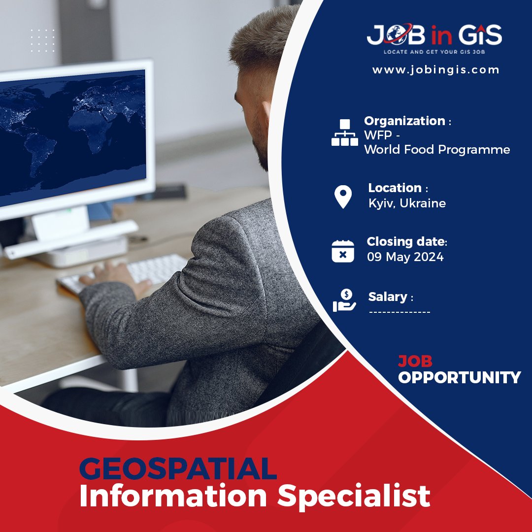
#jobingis: WFP is hiring a Geospatial information Specialist 📍: Kyiv, Ukraine Apply here 👉 : jobingis.com/jobs/geospatia… #Jobs #mapping #GIS #geospatial #remotesensing #GISjobs #Geography #cartography

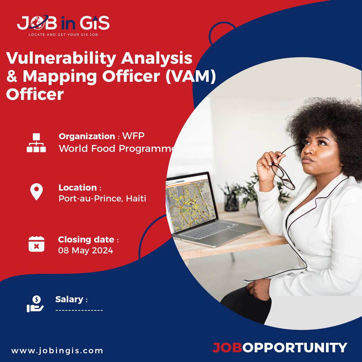
#jobingis : WFP is hiring a Vulnerability Analysis & Mapping Officer (VAM) Officer 📍 : #PortauPrince #Haiti Apply here 👉 : jobingis.com/jobs/geospatia… #Jobs #mapping #GIS #geospatial #remotesensing #GISjobs #Geography #cartography

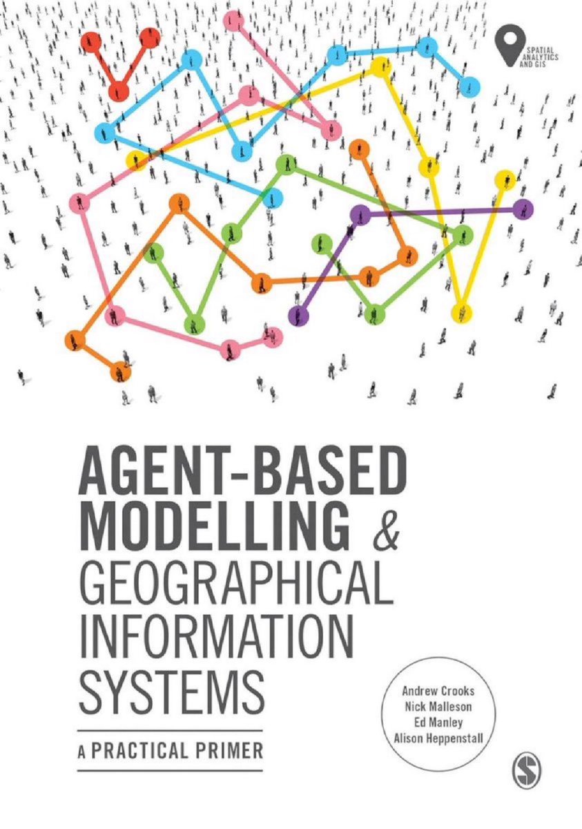
"Agent-Based Modelling and Geographical Information Systems: A Practical Primer (#GeoSpatial Analytics and #GIS)" amzn.to/3b26CK9 ——— #BigData #DataScience #AI #ComputationalScience #SocialScience #AgentBasedModeling #NetworkScience #SpatialAnalysis
Its official! CPD Points have been designated to Locate24 🙌 If you haven't yet registered, make sure you do so today! Spaces are filling up fast: bit.ly/3PvBB4P For a full list of CPD point allocations, click here: bit.ly/44h79li #Locate24 #Geospatial


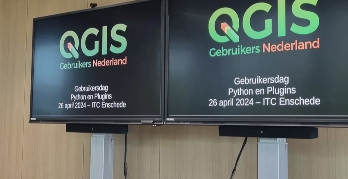
I had an amazing QGIS User Day at ITC yesterday! 🌟 It was fantastic to connect with fellow GIS enthusiasts and exchange insights on utilizing #PyQGIS, the Python programming framework within the #QGIS environment. #QGISNL #PyQGIS #Geospatial


#geospatial #opendata in action! 🙂

#geospatial #opendata in action! 🙂


#GeoNode is a popular #geospatial content management system that allows users to create and share data and interactive maps. AcuGIS includes all you need including the latest version of #GeoNode, #GeoServer, and more. Get started at acugis.com/geonode-hostin…
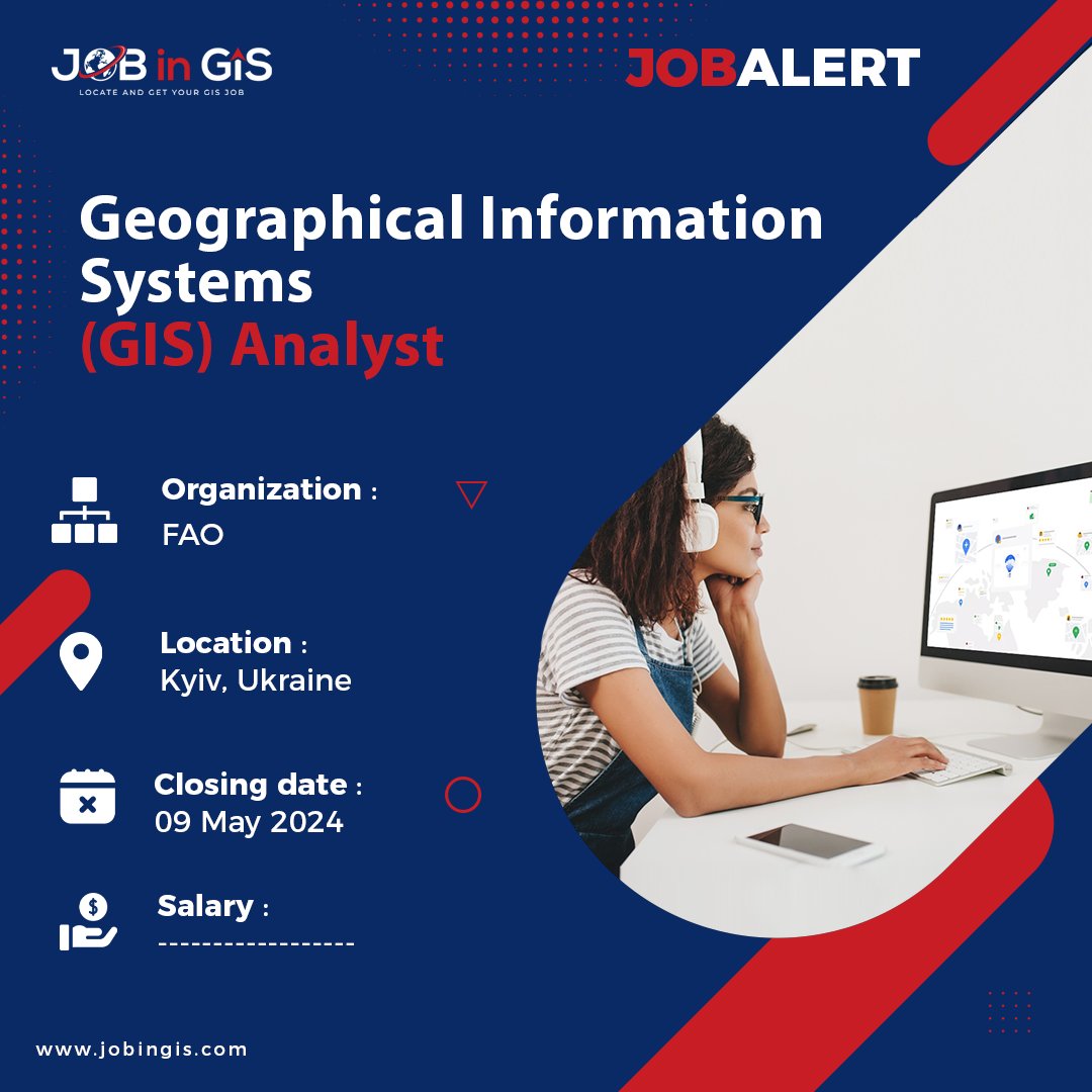
#jobingis : UNDP is hiring a Geographical Information Systems (GIS) Analyst 📍 : #Kyiv #Ukraine Apply here 👉 : jobingis.com/jobs/geographi… #Jobs #mapping #GIS #geospatial #remotesensing #GISjobs #Geography #cartography #remotejob
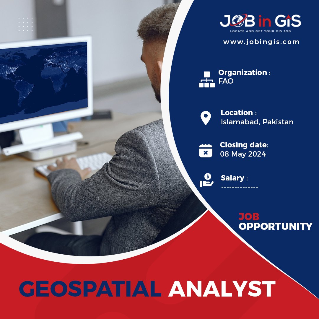
#jobingis: FAO is hiring a GEOSPATIAL ANALYST 📍: #Islamabad #Pakistan Apply here 👉 : jobingis.com/jobs/geospatia… #Jobs #mapping #GIS #geospatial #remotesensing #GISjobs #Geography #cartography #remotejob

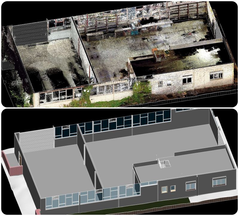
Scan-to-Bim Process #laserscanning Bim modeling #Revit Rvtcad.com here for you to accurately convert your Scan data into 3d model. #Pointcloud #bim #Gis #autocad #scantobim #landsurveying #geospatial #laserscanning #Revit #Freelancer #3d #Mep #Lidar

Welcome to Your Ultimate GIS Mapping Partner, where precision meets expertise to elevate your mapping endeavors. 𝗚𝗘𝗧 𝗜𝗡 𝗧𝗢𝗨𝗖𝗛 𝗪𝗜𝗧𝗛 𝗨𝗦:- ✉️ [email protected] 💻 proffereng.com #GISMapping #SpatialAnalysis #Geospatial #MappingSolutions

The 'Call for Abstracts' is currently open until 9th May for the State of GIS event taking place in Hobart on 6th June. Find out more here: bit.ly/43VkJKM You can view the Sponsorship Prospectus here: bit.ly/3UAFloA #GIS #geospatial #callforabstracts


TechMental anchors Geospatial (AR) Augmented Reality media on the high seas in the form of 17th Century Pirate ships off of Miami's Biscayne Bay... @dns As Seen On 🏴☠️ dns.xyz/techmental/ite… #AR #Geospatial #Glitch #Teztrash #Vessels #Piracy #Caribbean #Miami #VaporWave #Web3

📰 #ArcGIS Blog: Using Arcade to Translate Pop-Ups for Use in the ArcGIS Instant Apps esri.com/arcgis-blog/pr… _ #Esri #GIS #Geospatial #MetaMapping

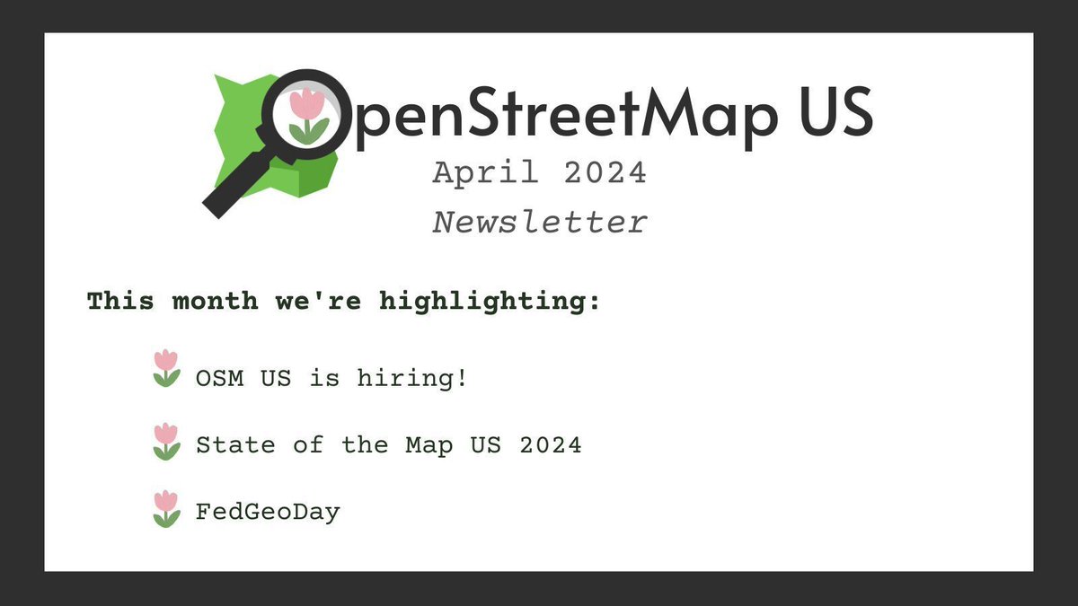
🤓 Read our April newsletter and catch up on all things OSM US 🔗 buff.ly/49Vpe9P #OpenStreetMap #OpenStreetMapUS #geospatial #opensource
📰 #ArcGIS Blog: ArcGIS Configurable Apps Roadmap for Retirement esri.com/arcgis-blog/pr… _ #Esri #GIS #Geospatial #MetaMapping

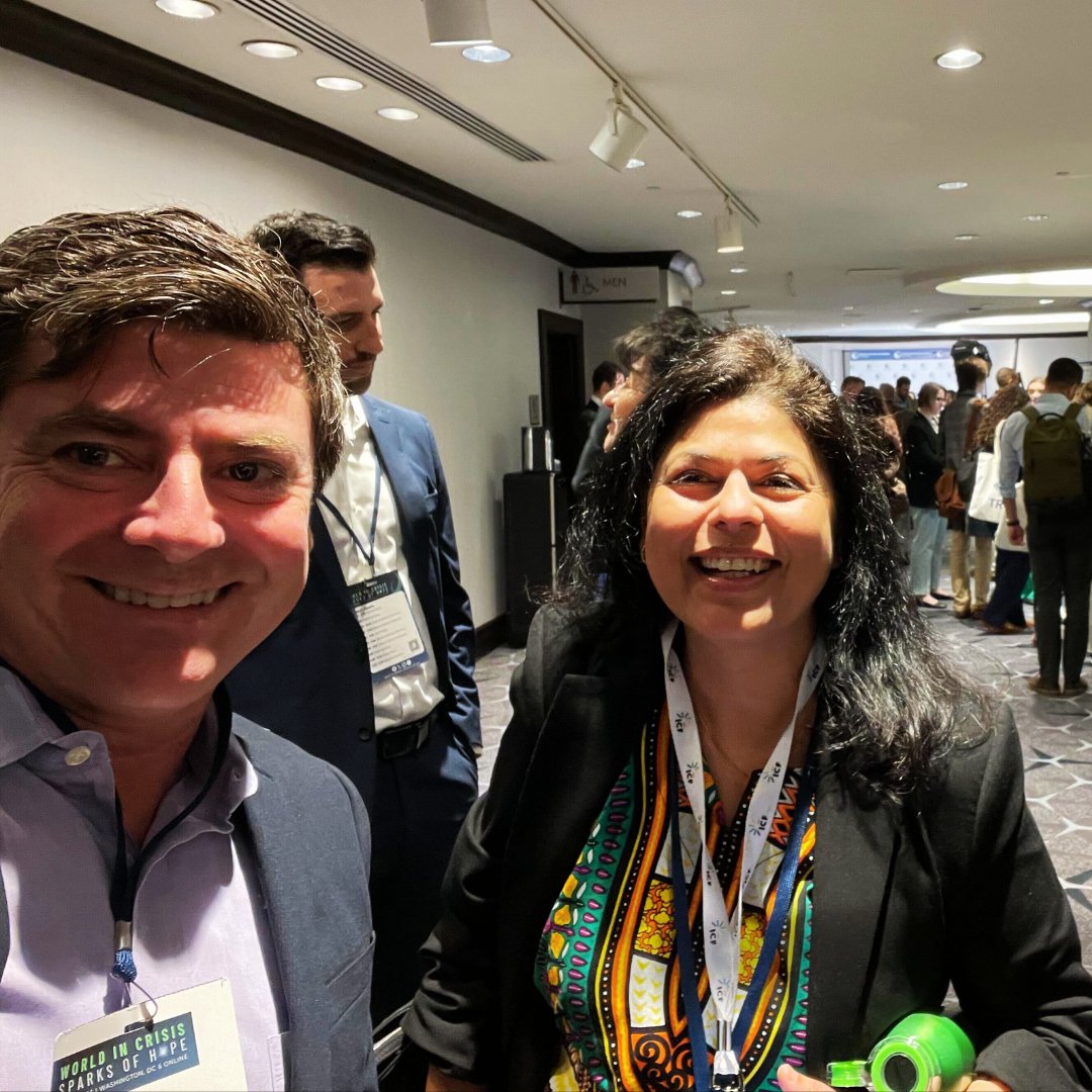
🤝 Great catching up with Cari Deschak & Monica Kothari from the SMRFS Team at #SIDUSConference in DC! Thrilled to see partners like Heifer, Abt, Winrock, DAI, Tetra Tech, Chemonics, AIR, PlanetAid & FHI 360 making strides in development. #BlueRaster #Geospatial


geospatial @geospatial
878 Followers 454 Following Maker of maps, lover of geography, designer of information & dataviz, and life-long computing geek.
Open Geospatial: OGC @opengeospatial
27K Followers 250 Following OGC’s member-community of experts makes location data Findable, Accessible Interoperable, and Reusable (FAIR) through #innovation #collaboration and #standards
OSGeo https://fosstod.. @OSGeo
32K Followers 197 Following The Open Source Geospatial Foundation... search for our local chapters around the world as well. See you at https://t.co/mCjhOCQaoy
Geospatial Python @geospatial_py
4K Followers 0 Following A Twitter bot that automatically retweets everything about #geospatial #python stuff. #geopython #GIS #RemoteSensing #Jupyter.
Geospatial World @geoworldmedia
33K Followers 3K Following Your trusted knowledge source for all things geospatial. We delve into tech convergence and pivot to Industry 4.0 via Digital Transformation and Sustainability
Trimble Geospatial @TrimbleNews
10K Followers 182 Following Leading provider of advanced positioning solutions for survey and geospatial professionals that maximize productivity and enhance profitability.
NGA @NGA_GEOINT
100K Followers 277 Following This is the official Twitter account for the National Geospatial-Intelligence Agency.
GW Events @GeospatialM
3K Followers 175 Following Premium Geospatial events produced by Geospatial World
Geospatial Data Scien.. @SpatialML
1K Followers 38 Following Spatial Data Science Publication @shakasom
Hexagon Safety, Infra.. @HexagonSIG
10K Followers 624 Following Improving resilience and sustainability for the world’s critical services and infrastructure | Part of @HexagonAB
Army Geospatial @ArmyGeospatial
1K Followers 270 Following Official site of the Army Geospatial Center. Providing #USArmy timely, accurate, and relevant geospatial information and capabilities. (F/RT/L ≠ endorsement)
Defence Geospatial @DefenceGIS
3K Followers 542 Following Defence Geospatial Intelligence (DGI) The Premier Defence & Intelligence Conference
Geospatial World Risi.. @GW_RisingStars
624 Followers 0 Following An annual list of Rising Stars representing the future of Geospatial industry
Women+ in Geospatial @geospatialwomen
10K Followers 305 Following An inclusive and global community that inspires, unites and empowers women+ in the geospatial field to become strong leaders and changemakers! Join us👇today!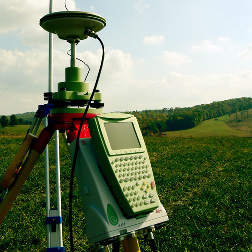
Geospatial Stuff @GeospatialStuff
6K Followers 5K Following We tweet everything Geospatial related including GIS, geomatics, drones, open data, location technology, maps & much more
NV5 Geospatial Softwa.. @GeoByENVI
8K Followers 541 Following NV5 Geospatial Software is part of @NV5Geospatial. We help professionals access, analyze and share geospatial data and imagery to solve critical problems.
NV5 Geospatial @NV5Geospatial
6K Followers 5K Following Formerly Quantum Spatial, we are the geospatial pioneer: Delivering data + analytics, providing geospatial insights to government and corporate organizations.
Esri Geospatial @Esri_Geospatial
7K Followers 3K Following
Geospatial Engineerin.. @uongeospatial
869 Followers 57 Following Official Twitter account for the Department of Geospatial and Space Technology, University of Nairobi
Badan Informasi Geosp.. @InfoGeospasial
28K Followers 132 Following Bersama menata #TanahAirKita Indonesia lebih baik. #1Peta1Data1Nusantara 🗺️🇮🇩
Monde Geospatial @MondeGeospatial
11K Followers 3K Following Geospatial videos, news, articles and events relating to #GIS, #cartography, #RemoteSensing, #GPS, #Surveying, #Geomatics and #geospatial technologies
Whitebox Geospatial @whiteboxgeo
7K Followers 2K Following Innovative geospatial software solutions built on open-source. #lidar #TerrainAnalysis #geospatial #GIS #remotesensing #geomorphometry #geomaticsOpen Geospatial: OGC @opengis
459 Followers 1 Following The OGC is an international consortium where members participate in a consensus process to develop publicly available geospatial standards.
国土地理院 @GSI_chiriin
57K Followers 49 Following 国土地理院公式アカウントです。 地理空間情報、災害・防災に関する情報などを発信します。 【運用方針】https://t.co/94vySsSQ3B 【問合せ窓口】https://t.co/pvCiRjjE8H
World Geospatial Indu.. @WGICouncil
2K Followers 298 Following Advancing the role of the geospatial industry and strengthening its contributions to society and the global economy.
GeoSpatial Stream @GSpatialStream
2K Followers 1K Following A video digest of geospatial news you need to know
Africa Geospatial Con.. @africageoconvo
1K Followers 78 Following A podcast showcasing geospatial professionals in Africa. By @svelte_mo & @jeafreezy Listen & Subscribe: https://t.co/dFbyT04CEd 📧 africageoconvo@gm
Geospatial Advocacy K.. @GeospatialK
1K Followers 325 Following We promote and advance the geospatial industry in Kenya and beyond. Find us on Meetup for event updates and on Telegram for more geo-information from Kenya.
Geospatial Commission @GeospatialC
4K Followers 274 Following We are an expert committee within @SciTechgovuk that sets the UK’s geospatial strategy and promotes the best use of location data.
Oswald.art🎨#Geospa.. @oswvldo_onielll
3K Followers 2K Following Busy solving problems with Geospatial tools, oh you may catch me painting and listening to sweet melodies/#GIS #GreatIfe #WizkidFC🦅#African
Cloud-Native Geospati.. @cloudnativegeo
955 Followers 113 Following Increasing adoption of cloud-native geospatial data.
Geospatial Society of.. @GeoSociety_Ke
894 Followers 194 Following GeoSk encourages, supports and engenders innovation, development and appropriate use of geospatial technologies in Kenya. Founded in 2014.
2nd UN World Geospati.. @UN_WGIC2022
238 Followers 14 Following Global Geospatial community will convene for the 2nd UN World Geospatial Information Congress from 10-14 Oct 2022 at Hyderabad, INDIA. Stay tuned for updates.
NC State Center for G.. @NCSUgeospatial
2K Followers 360 Following Everything is spatial and location matters at the Center for Geospatial Analytics, an interdisciplinary teaching and research center at NC State University.
UGRC Utah Geospatial .. @MapUtah
564 Followers 21 Following The Utah Geospatial Resource Center (UGRC) provides mapping technology services to federal, state, and local governments and other organizations.
CyientGeospatial @CyientGeo
2K Followers 697 Following Aerial surveying and data acquisition solutions provider for the Geospatial and Utilities sectors
Nordic Geospatial �.. @nordicgeo
4K Followers 5K Following Danish Refugee Council 🇩🇰 DEEP - Humanitarian AI / OpenData / GIS / ICT's & @WHO Advisor - RT does not = an endorsement.
Murphy Geospatial @m_geospatial
2K Followers 1K Following Murphy Geospatial captures, collates, verifies and governs #geospatial data.
Geospatial Insight @geo_insight
892 Followers 601 Following Geospatial Insight is a leading provider of independent research derived from the analysis of satellite, aerial and drone imagery.
Project Geospatial @ProjectGeoMedia
2K Followers 714 Following A geospatial non-profit committed to increasing awareness of #geospatial technology, industry best practices, and educational resources. #GIS #Geography #GEOINT
K-State Geography and.. @kstate_geog
1K Followers 123 Following Prepare for a top-ranked science career at the intersection of nature, society, and technology and make a positive impact on both people and the planet!
UN-GGIM @UNGGIM
4K Followers 139 Following
Geospatial Now @geospatial_now
2K Followers 1K Following Interested in #Geospatial News? Install Geospatial Now from play store. #remotesensing #drones #gis #lidar #mapping #geospatial #AI #gps
Geospatial Council of.. @geo_council
810 Followers 127 Following Australia's peak body for the geospatial community was formed from the merger of SSSI and SIBA in March 2023. New members welcome.
elaine ball - The Geo.. @EballBall
2K Followers 2K Following 👉The Geospatial Marketing Consultant 👉Owner of the Geospatial Marketing Academy (GMA) 👉 Co-Founder of Get Kids into Survey
Geospatial Semester @GeoSemester
230 Followers 12 Following A partnership between high schools in Virginia and James Madison University allows students to learn geospatial technologies and earn credit from JMU.
Luna Geospatial, Inc. @LunaGeospatial
1K Followers 1K Following Open source GIS consulting, training, support, software development, and servers-as-a-service. We are pros with #QGIS #PostGIS #Geoserver and more.
Geospatial Innovation.. @GeosaurusTREX
491 Followers 88 Following The center for #geospatial tech innovation and collaboration in STL, and around the 🌎. An initiative of @DowntownTREX - Powered by @BayerUS.
Geospatial Education .. @PennStateGIS
2K Followers 390 Following We Are Penn State's Online Geospatial Education programs. Offering online classes, certificates, and degrees in GIS, Programming, GEOINT, and Remote Sensing.
GeospatialRevolution @geospatialrev
3K Followers 501 Following Public media and outreach initiative about the world of digital mapping and how it is changing the way we think, behave, and interact.
AFRO🌍TECH💻 #Geo.. @_francisodero_
3K Followers 2K Following @wemappers | Ecoscope Engineer @MaraElephant | GIS Software Developer | Google Earth Engine | #Python #GeoDjango GitHub - https://t.co/xNEVeTHhit
Lawrence #Geospatial�.. @lawrence_kim_
2K Followers 2K Following #gis & Remote Sensing | Geospatial developer | DS | Python | R | JavaScript | #ArcGIS| #earthengine | AI/ML | Freelance +254759629059 | open to work #gischat
Geospatial Systems CD.. @GeospatialCDT
570 Followers 152 Following EPSRC Centre for Doctoral Training in Geospatial Systems
Geospatial Solutions @GSS_NCM
2K Followers 412 Following
Space & Geospatial at.. @IUK_Space
1K Followers 560 Following Part of @IUK_Connect, we help turn innovative ideas into real-world solutions. Listen to our #Geo4Earth podcast: https://t.co/kL5J0dXwg1…
Geospatial @ UCLA @geospatialucla
365 Followers 100 Following GIS and geospatial education, research, and tools for UCLA and the world
Ziongate Geospatial �.. @ziongate_gis
650 Followers 230 Following We are a company in Ghana with unique expertise in delivering best-in-class #geospatial solutions based on #GIS #RemoteSensing and #UAV technology.
Sambus Geospatial Nig.. @SambusNigeria
498 Followers 130 Following Official Distributor for Esri ArcGIS, NV5 Geospatial's ENVI + IDL Software, Trimble GPS Devices and WingtraOne Drones. GIS Consultancy & Product Training.
Clark Center for Geos.. @ClarkCGA
144 Followers 9 Following Center for Geospatial Analytics at @ClarkUniversity
Geospatial Science an.. @GSHS_ORNL
657 Followers 110 Following We perform interdisciplinary research and development at ORNL to provide novel data and analytical technologies for human security.
Geospatial Centroid @Centroid_CSU
765 Followers 295 Following centroid: (n) 1. center of gravity of an irregularly shaped polygon. 2. virtual center of geospatial technologies and activities at Colorado State University.
G-DEV🌎🖥 @GeospatialDev_
1K Followers 690 Following We are a group of @DeKUTKenya Geospatial students doing Software Education|Data Analysis|GIS Programming|Surveying|RemoteSensing|[email protected]
Kongsberg Geospatial @KongsbergGeo
510 Followers 238 Following At Kongsberg Geospatial, we build Precision Real-Time Software for Mapping, Geospatial Visualization, and Situational Awareness.
Teledyne Geospatial @tdygeospatial
2K Followers 577 Following The unification of Teledyne’s Optech and CARIS businesses to offer holistic solutionsGeospatialPython.com @SpatialPython
1K Followers 131 Following Points. Polylines. Polygons. Pixels. Python!
Cloudpoint Geospatial @CloudpointGeo
526 Followers 273 Following Geospatial Consultant: GIS, Public Works, Facilities, Land Records, Utilities, Local Government, ArcGIS Enterprise, Data, Esri Silver Business Partner
TaylorGeospatial @TaylorGeoSTL
686 Followers 404 Following TGI is a consortium that fuels research, collaboration, and impact while serving as the cornerstone of a global center of geospatial excellence in St. Louis.
Geospatial Newcastle @GeospatialNCL
729 Followers 250 Following The Geospatial Engineering group @EngineeringNCL @UniofNewcastle. # |GIS |GNSS |RemoteSensing |Surveying
GeospatialNet @GeospatialNet
1K Followers 2K Following Geospatial videos, articles, Maps and news relating to #Geomatics, #GIS, #RemoteSensing, #Surveying, #GPS and #Geospatial Technology.
UCR Center for Geospa.. @spatialucr
628 Followers 85 Following The @UCRiverside Center for Geospatial Sciences (CGS), Established in 2017. Open Spatial Analytics for Science, Policy, & Community. #UCRCGS
Hakai Geospatial @HakaiGeospatial
518 Followers 197 Following Hakai Institute geospatial technology team. Surveying BC's coast from Icefield to Ocean!
Donald W. Hamer Cente.. @MapsLibraryPSU
416 Followers 649 Following Donald W. Hamer Center for Maps & Geospatial Information
SCCON Geospatial @sccongeospatial
177 Followers 8 Following Bem-vindo à página da SCCON Geospatial no Twitter.
Geospatial Insurance .. @gic_org
579 Followers 526 Following High-resolution aerial imagery and geospatial data for insurance & emergency disaster response. The GIC is an at-cost, member-driven initiative of the NICB.
MAGIRT Geospatial @MAGIRTala
319 Followers 131 Following Map and Geospatial Information Round Table (MAGIRT) of the American Library Association (ALA). We are professionals who love maps, GIS & all things geospatial.
IMGeospatial, World G.. @IMGeospatial
422 Followers 158 Following CHANGE THE WAY YOU SEE YOUR WORLD. AUTOMATED BUSINESS INTELLIGENCE
Geospatial Research I.. @GeospatialNZ
351 Followers 120 Following The GRI (at University of Canterbury, New Zealand) provides a unique opportunity for all branches of the geospatial community to communicate and collaborate.
UN Integrated Geospat.. @UN_IGIF
282 Followers 129 Following UN #IGIF - Enabling a Better Future with Location Data. Developed & endorsed by UN to help strengthen national #geospatial information management.
Geospatial Ventures L.. @GVL_Solutions
426 Followers 415 Following GVL provide geospatial solutions across a range of industry sectors
The Geospatial @TheGeospatial
799 Followers 2K Following Fastest growing Geospatial portal. Download our APP from Play store. All about #gis #geospatial #lidar #maps #isro #iot #gps #gnss #BIM #location #drones
GeospatialHealth @GnosisGIS
587 Followers 457 Following The International Society of Geospatial Health. A Network & Journal of collaborating health & earth science researchers working w GIS-based disease control.
Stanford Geospatial @stanfordgis
270 Followers 57 Following Providing support for the use of GIS and geospatial technologies in research and teaching at Stanford University.
Geospatial Technologi.. @gisworkshops
579 Followers 342 Following @UNHExtension's Geospatial Technologies Training Center helps NH citizens (and others!) use digital mapping in their lives. Comments & RT ≠ endorsements.
Seiler Geospatial @SeilerInst
544 Followers 292 Following Offering leading industry products & professional support/training/services to Surveyors, Engineers, Architects, Construction, Mapping/GIS professionals.
Think Geospatial @Think_Geo
572 Followers 730 Following Geospatial resources & info for K-12 teachers, students, informal educators & after-school enrichment. Tweets by Jenni Dahl, [email protected]
GeoMedia @geospatialWorld
262 Followers 124 Following Graphic designer, responsive web designer, popular science magazine editor, writer, blogger
K2 Geospatial @k2geospatial
644 Followers 213 Following K2 Geospatial’s solutions connect, consolidate, and publish data that is often managed and stored in silos throughout different systems.
GMIV (Geospatial Mode.. @GMIVvectormaps
237 Followers 199 Following We model the geographical distributions of vectors, their relative abundance, the prevalence of insecticide resistance in their populations, and their behaviour
Schneider Geospatial @GISSchneider
177 Followers 27 Following Providing innovative industry leading SaaS solutions and a full range of data conversion, technical support, training, and consulting services.
Geospatial Canada @GeospatialCan
1K Followers 638 Following Geospatial Canada 2015 is only a few months away! Share your thoughts here with #GCAN2015Geospatial Newsfeed @GeoMurmur
2K Followers 2K Following Mur-mur(noun): low continuous sound as of a brook, the wind, trees, or of low, indistinct voices. Geospatial(adj): relating to positions on the earth's surface
Iconic_Geospatial_Sur.. @GtFlakes
704 Followers 915 Following GIS Specialist&Analyst Geomatics RCMRD member Python, & R Programmer Call/WhatsApp text@0112241572 Photogrammetry Radar&Lidar Remote sensing Mapping Drones
Spexi Geospatial @spexigeo
185 Followers 70 Following Empowering drone pilots and making aerial data more accessible than ever.
Geospatial Metadata @geometadata
2K Followers 1K Following
Geospatial Data Scien.. @GeoDSGlasgow
186 Followers 92 Following Geospatial Data Science Group at Glasgow University
Geospatial Niagara @geoniagara
1K Followers 1K Following Promoting geo-literacy and community participation through geography. Spreading the Geographappiness!!
TrueNorth Geospatial @TrueNorth_geo
688 Followers 743 Following Powerful & extensible #geospatial #software for #backcountry adventurers. The power of #GIS & the usability of a word processor, by @TheBlueToque