Spatial YellowPage @spatialYP
The YellowPage for all spatial data and product listings! ✉️ [email protected] spatialyellowpage.vercel.app World Joined September 2022-
Tweets363
-
Followers242
-
Following124
-
Likes17
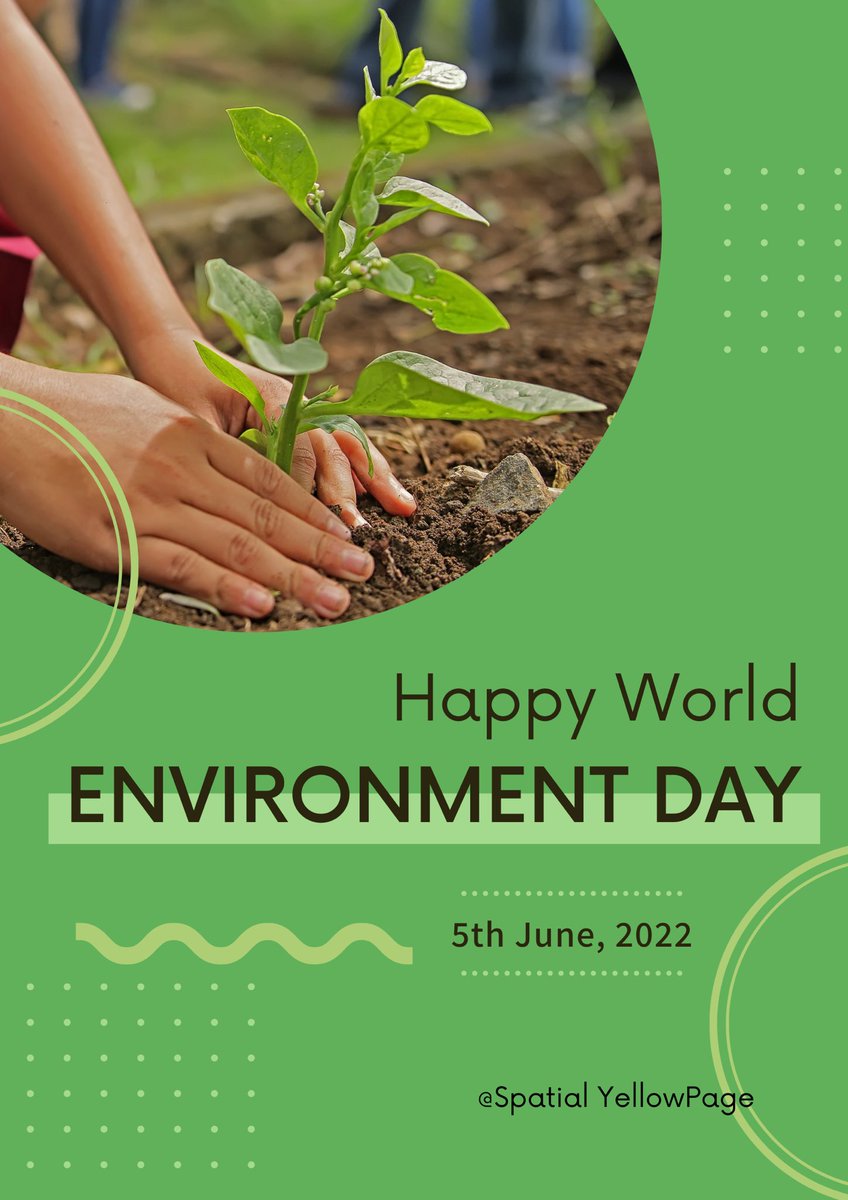
🌍Happy #WorldEnvironmentDay 2024! 🌿 We all have a role in protecting our planet. Simple actions: 1. Reduce waste 2. Save energy & water 3. Support reforestation 4. Use eco-friendly transport Together, we can create a sustainable future! 🌏 #Sustainability #GISForGood
Welcome to June! As we enter the peak of summer, let's embrace the extended daylight and vibrant energy of the season. Wishing everyone a month of productivity, growth, and meaningful achievements. #NewMonth #June #ProfessionalGoals #gis
Whether you're focused on large-scale monitoring or precise field-level management, the integration of these technologies will be pivotal in driving the future of sustainable agriculture. #research #agric #geospatial #opensource #gis #dataset #data
- Open Data Cube: Provides analysis-ready satellite data tailored for agriculture research. By harnessing these diverse spatial data sources, agricultural researchers and practitioners can gain deeper insights, optimize resource use, and enhance crop productivity.
4. Weather Data Accurate weather data is crucial for predicting and managing crop performance. Key sources include: - NOAA (National Oceanic and Atmospheric Administration): Offers extensive climatic data and forecasts. - Local Weather Stations: Provide real-time weather data
- Variable Rate Technology (VRT): Applying inputs like fertilizers and pesticides at variable rates across a field to optimize use and reduce waste. - Yield Monitoring: Collecting data on crop yields in real-time to analyze performance and make informed decisions.
3. GPS and GIS Systems Global Positioning System (GPS) and Geographic Information System (GIS) technologies are fundamental for precision agriculture, allowing for: - Field Mapping: Creating detailed maps for soil types, crop yields, and pest infestations.
NDVI (Normalized Difference Vegetation Index) analysis. - Soil and Irrigation Management: Assessing soil moisture levels and optimizing irrigation schedules. - Plant Phenotyping: Detailed monitoring of plant traits and growth patterns.
2. UAVs (Drones) Unmanned Aerial Vehicles (UAVs) equipped with multispectral and thermal sensors can capture high-resolution images at a lower cost and with more flexibility than satellites. They are perfect for: - Crop Health Monitoring: Identifying stress areas through
Explore Spatial Data Sources for Agriculture Research: From Crop Monitoring to Precision Farming In the age of digital agriculture, spatial data has become a cornerstone for advancing research and optimizing farming practices. Whether you're involved in
- Sentinel Satellites (Copernicus Program): Delivers high-resolution imagery for detailed crop health analysis. - MODIS (Moderate Resolution Imaging Spectroradiometer): Provides daily global data, aiding in tracking seasonal changes and vegetation health.
1. Satellite Imagery Satellites provide comprehensive coverage and frequent updates, making them ideal for large-scale agricultural monitoring. Key providers include: - Landsat Program: Offers historical data dating back to the 1970s, useful for long-term agricultural studies.
crop monitoring, soil health assessment, or precision farming, leveraging the right spatial data sources can significantly enhance your research and operational efficiency. Here’s a guide to some of the most valuable spatial data sources in agriculture:
Spatial data visualization transforms complex datasets into compelling visual stories, making data more accessible and understandable. By leveraging these tools, you can gain deeper insights, share your findings more effectively, and drive better decision-making.
[ArcGIS Online](arcgis.com). - Create a Map: Use the Map Viewer to add layers and customize the basemap. - Analysis Tools: Leverage built-in analysis tools to perform spatial queries and generate heat maps. Tutorial Highlight: Build an interactive map

Robin Cole @robmarkcole
12K Followers 4K Following Tackling the worlds toughest challenges with AI & ML applied to satellite & aerial imagery https://t.co/QmbOWgdfAZ
Ọmọwọnúọlá ... @Svelte_mo
2K Followers 2K Following Impact Driven. | Space tech (Earth Observation) and AI. 🌍🛰️📡
Arjen Vrielink @arjenvrielink
2K Followers 850 Following Owl at @satelligenceEO, RemoteSensing, OpenSource, theSwarm, Containers, Patterns. “Bacteria that turns shit into fuel” - the Mouth of Joe.
Lawrence #Geospatial�... @lawrence_kim_
3K Followers 3K Following #Geospatial & Remote Sensing | G.I.S developer | Vue JS | Python | R | #ArcGIS | #earthengine | AI/ML | #gischat
InfoSpatial @Info_Spatial
2 Followers 71 Following GIS Consultancy. Corporate GIS Training and Solutions.
Chiadikobi Ozor @chiadikobiozor
326 Followers 1K Following
Karthikeyan A @A_karthikn
191 Followers 2K Following Genomics l 🔭🔬| Cosmos | Climate change | Herbarium| Tree Phenology | PhD student | School of Biological Sciences | Madurai Kamaraj University| India | he/him
Stino_empire @empire_stino
40 Followers 356 Following web3 || urban planning || GIS || Remote Sensing ||
Charles 🇰🇪 @charlsonyango
566 Followers 6K Following 🇰🇪,passionate on increasing returns from smallholder 👩🌾.Works @TaitaTaveta006 , Agri Dep.Catch me @smartagricare- ag tweet @unimelb alumni.Views are my own
Michael | GIS & Hydro... @mike65395
439 Followers 4K Following Geospatial Developer/ Remote Sensing/ Hydrogeological Surveys Borehole site selection/ Web GIS solutions/ Founder, GeoHydro Borehole & GIS Solutions
Dhruvi Sedha @SedhaD6
5 Followers 80 Following PhD Scholar, ISRO I Forest Phenology I Climate Change I Remote Sensing I she/her


Collins💫 @Edemcollins1
209 Followers 939 Following Christian❤️ | @Erasmus_Mundus Scholar 24-26 | @GemMsc Student | GIS & RS | Philippians 4:4-6 | A Living Epistle unto Christ❤️🙌🏼 |
suhail khan ❄️�... @suhailk49329508
406 Followers 4K Following https://t.co/BJZIQV9YPu. (Hons) Geography🗺️🌏📗Student at Amity Institute of Geo-Informatics and Remote Sensing 📡🛰) Cryosphere, Geomorphology, Atmospheric science.
Nesit Abedje @nabedje
401 Followers 1K Following #Gis specialist , #gis, #digitalhealth, #Openstreetmap, #Opendata
Elisia Gottlieb @Ndahal_a
80 Followers 365 Following GIS | Remote Sensing | Agriculture | Land Use Planner

Mahadou @propmamadou
36 Followers 745 Following Learning. Software Engineering. Python. Geospatial #YNWA
carrajeen @carrajeen
123 Followers 357 Following Najeen PhD candidate studying Asparagopsis in the Great Barrier Reef from 🇵🇭 currently in 🇦🇺 Views expressed are my own.
Daniel Redel @DannyRedel
296 Followers 2K Following Data Consultant | MSc Econometrics @TilburgU | Applied Economics @IE_UC | Data Science & Analytics
ISAXON @isaxonWorldwide
249 Followers 2K Following Award winning | GIS & RS Consultant | Wits Alumni | ENKORP Consultancy

Dr Muhammad Moshiur R... @MoshiRahman18
25 Followers 120 Following Dr Moshiur Rahman is a senior researcher with more than 10 years’ experience in precision agricultural technologies, Remote Sensing and Crop-climate Modelling.


Juliet Ibenegbu @JulietAmaka18
1K Followers 691 Following GIS Specialist|| God First || Co-President @africwomeningis || Researcher || Backend Engineer
Samantha Wittke @swittke1
268 Followers 607 Following Application specialist @CSCfi | Community manager @coderefine | #PhDStudent at @fgi_nls & @AaltoUniversity | #RemoteSensing #Geoinformatics
Sricharan Srivatsa @meesacharan
189 Followers 2K Following Enjoy watching fluid football I Data Viz Noob I
Tim Gattinger @GattingerTim
519 Followers 2K Following Interests in AI with focus on remote sensing. Works as engineer in a project monitoring forests with remote sensing and AI In Schleswig-Holstein (Germany).
Sridhar Gutam, PhD, A... @SridharGutam
401 Followers 2K Following Alumni @iaripusa1, @IIMAhmedabad | ARS @icarindia @ICAR_IIHR | Convenor @OAIndia @IndiaRxiv @asia_open | Joint Sec @iarialumni | Org. Sec. @doasummit2026

FME Data Integration @SafeSoftware
5K Followers 2K Following Gain more value from data by connecting it across hundreds of sources with FME – the # 1 platform for integrating spatial data. #FME #DataIntegrationPlatform
Rufai Omowunmi Balogu... @robalogun
82 Followers 239 Following Utilizing Earth Observation Data Science for driving Sustainable Planetary Health || Young Professional Ambassador @grssyp

Sutoidem Theophilus @sutoidemtheo
349 Followers 1K Following Surveyor : Creative writer : Value faucet Diligence is the rut to success


SS @sskads
10 Followers 805 Following
Fausto B. Isolan @faustoisolan
223 Followers 2K Following Arquiteto e Urbanista | geotecnologias | SIG | dados abertos | mapeamento | participação pública
Daniel @dantricis
74 Followers 2K Following

Kiel @osifo4
218 Followers 2K Following SDGs Advocate l Environmental scientist l Project manager l Writer l Community advocacy I UNSDSN Local Pathways Fellow

Clinton Nwokocha @LeoClintonDozie
3K Followers 5K Following Environmental Geologist | GIS & Data Analyst | Passionate About Climate & Disaster Risk Management |Seeking MSc/PhD Opportunities in Remote Sensing & GIS
Willi Richert @willirichert
463 Followers 2K Following
Andres Herrera @andresherrera
766 Followers 2K Following MEng in Computer Science - Topographic Engineer-Geomatics Specialist-GIS & Remote Sensing Consultant-Open Software enthusiast. Bogotano-Caleño


Nelly Bosire @NellyBosire
0 Followers 141 Following
Joshua Amaitum @joshuaAmaitum
2K Followers 5K Following
Suranjith Bandara K @SuranjithK
265 Followers 1K Following Post Doc. in Earth System Science (Atmospheric). Looking into urban climate change issues. Love Photography & wildlife
Robin Cole @robmarkcole
12K Followers 4K Following Tackling the worlds toughest challenges with AI & ML applied to satellite & aerial imagery https://t.co/QmbOWgdfAZ
Arjen Vrielink @arjenvrielink
2K Followers 850 Following Owl at @satelligenceEO, RemoteSensing, OpenSource, theSwarm, Containers, Patterns. “Bacteria that turns shit into fuel” - the Mouth of Joe.
The African Phenology... @AfricanPhenoNet
297 Followers 258 Following Ecological monitoring for a thriving planet. Connecting ecologists and meteorologists across the African continent.
Sridhar Gutam, PhD, A... @SridharGutam
401 Followers 2K Following Alumni @iaripusa1, @IIMAhmedabad | ARS @icarindia @ICAR_IIHR | Convenor @OAIndia @IndiaRxiv @asia_open | Joint Sec @iarialumni | Org. Sec. @doasummit2026
FME Data Integration @SafeSoftware
5K Followers 2K Following Gain more value from data by connecting it across hundreds of sources with FME – the # 1 platform for integrating spatial data. #FME #DataIntegrationPlatform
RACHELLE @omo_kosoko
789 Followers 292 Following Feminist | Surveyor | Well-behaved women seldomly make history
Levi @levikul09
39K Followers 192 Following I explain Data Science on Grandma's level. Writing https://t.co/25jLCDRZms
Matt Dancho (Business... @mdancho84
100K Followers 519 Following Generative AI, Data Science, Python, and Business (ROI). Join my next live AI workshop (free).👇
Liam Khiden @LiamKhiden
121 Followers 2K Following
Zekier @stirredporridge
87 Followers 231 Following
Mike Koontz, PhD @_mikoontz
1K Followers 2K Following Research Fire Ecologist @USGS | Formerly @VibrantPlanet_ @EarthLabCU @ucdavis | Geospatial data science, #wildfire, #drones, #rstats, mountains he/him
Chenyang Wei (魏辰�... @Chenyang_Wei
86 Followers 353 Following
James X-Freeman @JamesXFreeman
545 Followers 3K Following Cranky old contrarian, but not one you know #WeAreSovereign
Louise Rayne @LouiseRayne1
781 Followers 926 Following Archaeologist and remote sensing specialist at Newcastle University @ArchaeologyNCL. NUAcT fellow in sustainable ancient water management.
George Dyke @GeorgeDyke
466 Followers 2K Following NaN - Technology, Space Industry, Sports, Fantasy Sports, Active: To Learn, To Lead, To Love. Also tweeting @teslajourney.

Satish Puri @satishpuri2013
117 Followers 421 Following Associate Professor, Computer Science, Missouri University of Science and Technology. Research on parallel computing and GPU computing for geospatial data.
Elisha Richardson @_elishaR
96 Followers 191 Following MSc Student ••• Carleton University ••• Remote Sensing Enthusiast 🛰🌎 ••• She/Her
Monique.Lehman.GIS @MoniqueGis
6 Followers 115 Following
David Berry @David_I_Berry
340 Followers 527 Following
Jasmine Muir @monkeyspyda
839 Followers 1K Following Remote sensing scientist, laser scanning enthusiast, and Python programmer - exploring new ways to observe the earth. PhD in Terrestrial Laser Scanning.
Philippa Burgess, MA,... @philippaburgess
9K Followers 3K Following Principal, GeoCyber Systems LLC | Geospatial, Cloud/AI & Security | NatSec at USC, Esri YPN, WTM, NICE CC, MSA Gold Ambassador

Horacio @ahbritos
1K Followers 4K Following Remote Sensing, SAR, Forest Management, Agricultura de Precisión, Agropymes. Box fan.
听音 @wengqian053
63 Followers 2K Following 学而无成,唯有持学。The research interest is the intelligent content recognition and processing of high-score remote sensing imagry.
Melati @melati_aj
171 Followers 277 Following Always learning. Geography. Geospatial. @NagoyaUniv and Unisel grad, now with RNRCGeospatial #humangeography #mcfc

Elizabeth Tulanowski @hethbill
795 Followers 160 Following Geospatial educator and enthusiast, Senior Instructor at CSU, spreading the word about geospatial stuff in Colorado. Also @[email protected]
Edy @EdyLc9
350 Followers 3K Following Researcher-Glacier mass balance,Remote sensing, GIS, SAR, Google Earth Engine, Glacier, Water, Hydrology, Environmental Engineering, Cordillera Blanca

Benchmrk App @_Benchmrk
96 Followers 209 Following The quickest way to find survey control in Australia
AT_Geomatics @AT_GEOMATICS
266 Followers 912 Following GIS Consultant - Orthoimagery Specialist - Cartography - Data & Research Services - Mapping the Geospatial Journey 🛰🌎🌍🌏🗺🗾 DM for project inquiries.

SuperMap @SuperMap__GIS
7K Followers 4K Following GIS platform software and solution provider. Innovate Geospatial Intelligence, Elevate IT Value. #GIS #3DGIS #BigDataGIS #AIGIS #BIMGIS

Dr. Barjeece Bashir @barjeece
239 Followers 1K Following Postdoc | Studying snow algae blooms & their role in Antarctic snow melt | Polar microbial ecology | Melting ice, greening snow 🌿❄️ | Views my own
AWIS Weather Services @AWISWeather
298 Followers 934 Following 25+ Yrs in the Weather Business | Data | Forecasts | Frost Freeze Alerts | Agriculture | Energy | Construction | Analytics | https://t.co/MeeGRKkZkk
Shane Smith @Smith80D
141 Followers 1K Following
Kyle Woodward @KD_Woodward
53 Followers 91 Following applying #geospatial technology for good at @sig_gis
Ranjit Behera @the_ranjit10
32 Followers 44 Following Author | Geospatial Researcher | Spatial Analytics
Josh Beauchamp @JoshBeauchamp8
44 Followers 368 Following
Jonathan Heath @welshman001
709 Followers 173 Following
Hugo @seixasthugo
57 Followers 663 Following PhD student, research on land cover transitions impacts. https://t.co/YlkxVkMtG3
Micah @mukolx
163 Followers 848 Following
Makeke Maombo @emaombo
171 Followers 825 Following Geo-Awareness/Intelligence~ Geospatial ~ Geography |MSc GIS @UniversityLeeds |Chevening Scholar 2020/21 @CheveningFCDO | God Above All.
Enock Abung'ana @abunganaEnock
109 Followers 405 Following AI/ML & Data Engineer | Generative AI & LLM Optimisation | GIS/Remote‑Sensing Analytics | Cloud‑Native Pipelines Driving Humanitarian Impact
#geoObserver 🌍🔭... @geoObserver_
2K Followers 1K Following 1. Brauchen wir keinen Raumbezug und 2. ist die Erde eine Scheibe. 1. we do not need a spatial reference and 2. the earth is a disc.
Subesh Bhattarai @Subsonicu571
7 Followers 167 Following
Yaser @YABSHD
22 Followers 503 Following

Trends for United States
You might like