Search results for #swiwx

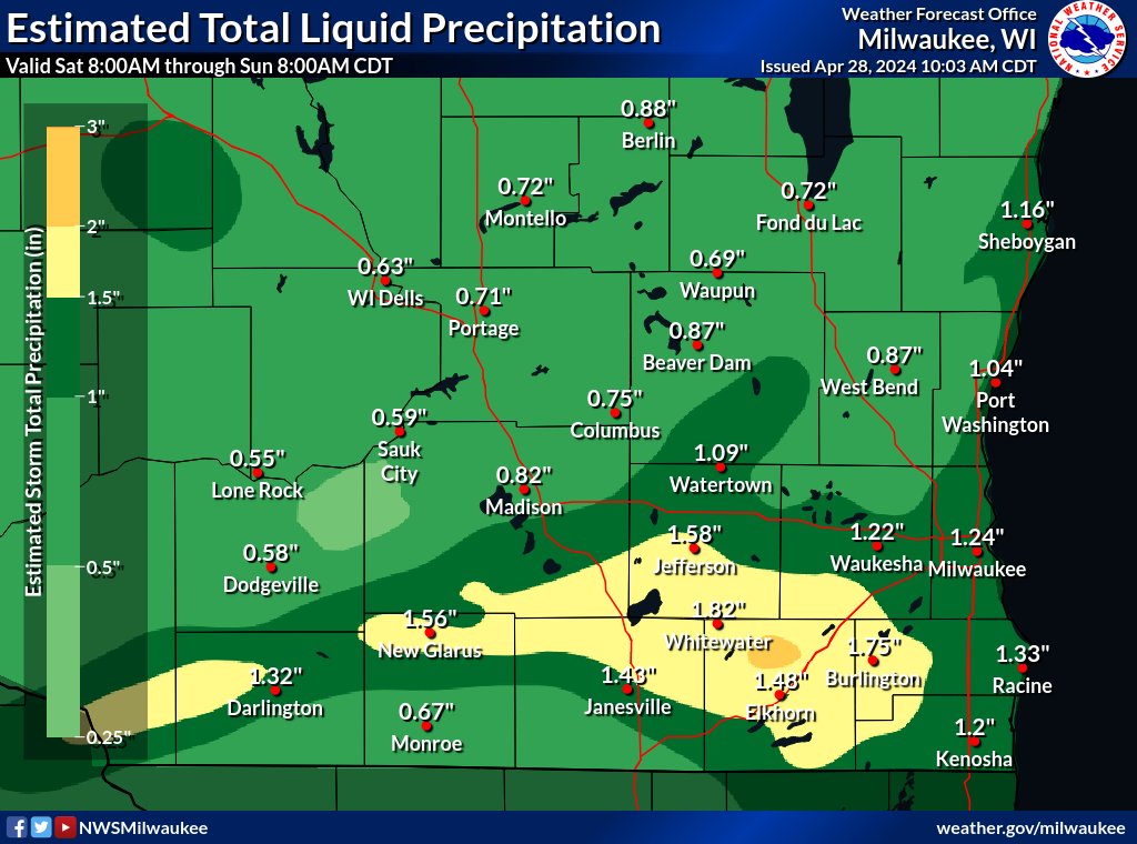
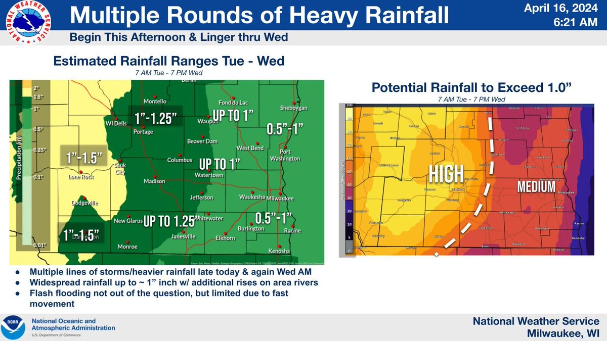
Estimated 3-day rainfall total from multiple rounds of showers and storms in southern WI Fri-Mon morning #swiwx #wiwx


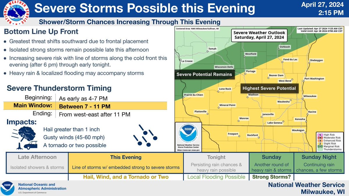
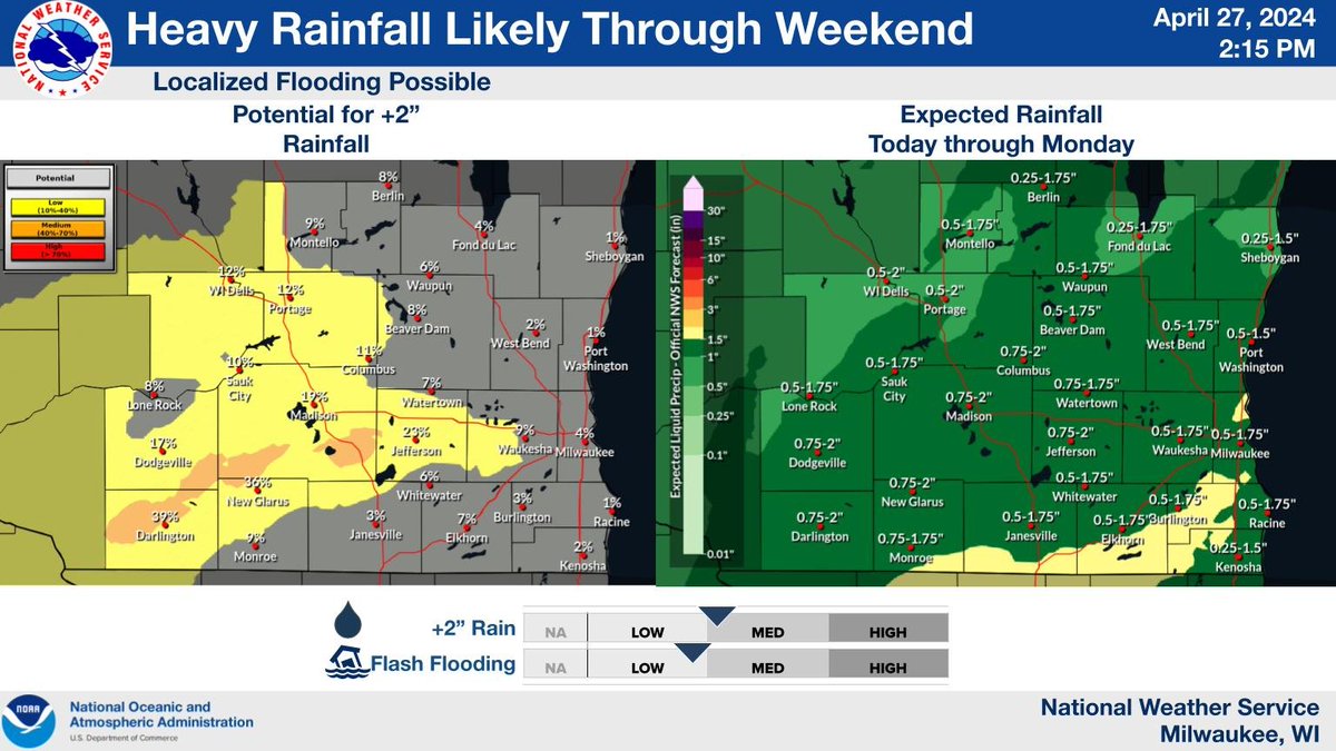
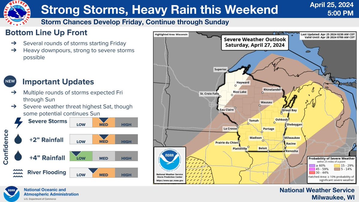
Rounds of showers and storms are expected from Fri afternoon into Sun nt. The heavy rain 🙴 severe storm potential will be most focused late Sat-Sun. Be sure to check back over the next day or two as details are refined. #swiwx
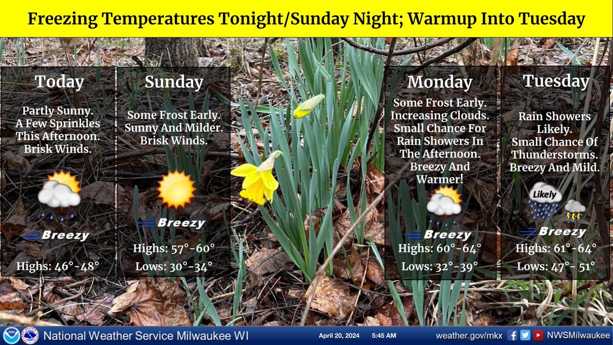
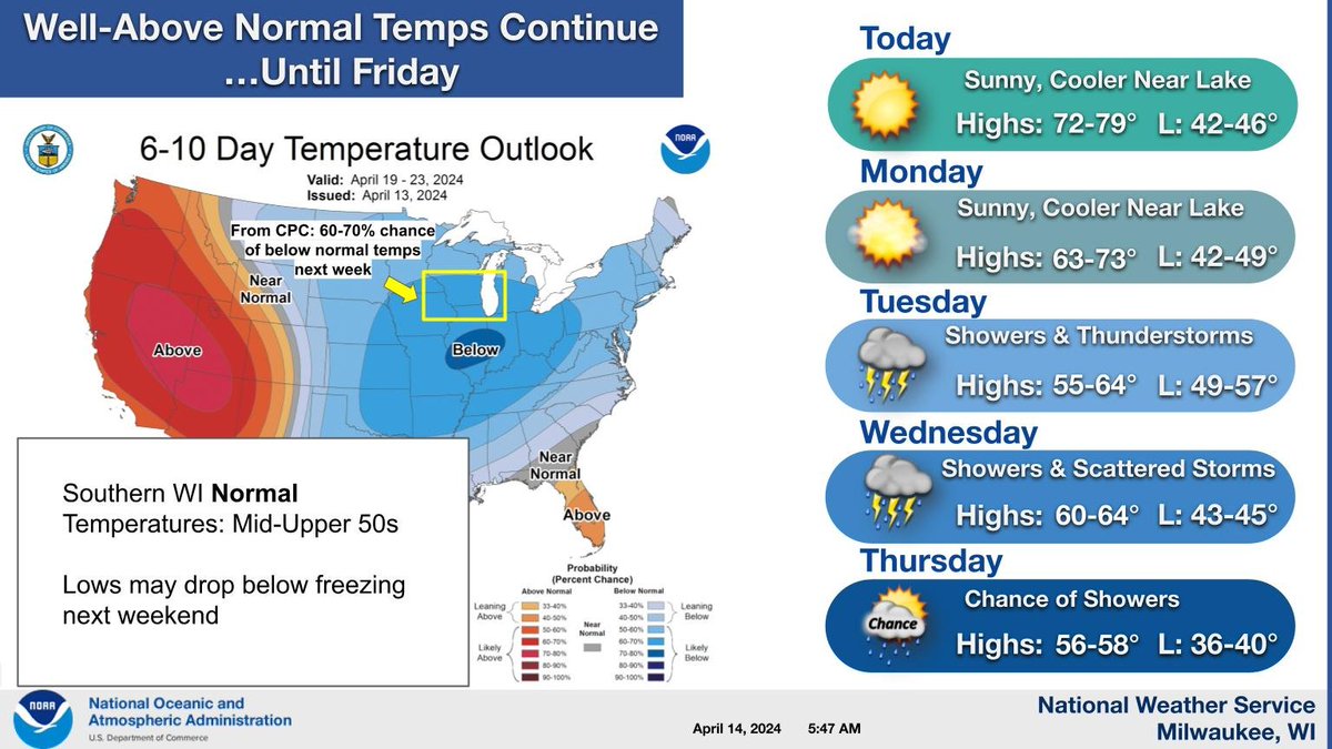
Temperatures are on track to fall below freezing late tonight. A Freeze Warning is in effect. #swiwx


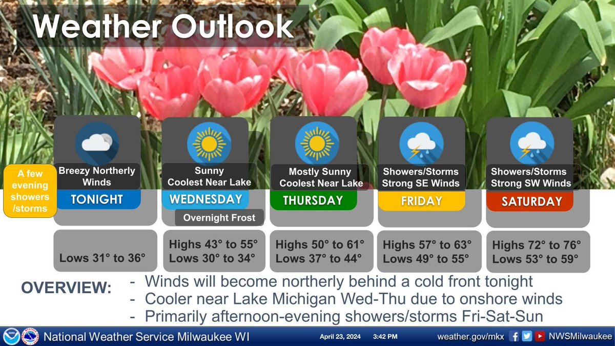
West winds gusting to 35 MPH today, with a few gusts to 40 MPH possible. It will feel chilly today and Saturday. Patchy frost and localized freeze conditions are possible each night through this weekend, so make sure to check on sensitive plants. Warm end of April likely. #swiwx


We have a #Tornado WARNING + sirens going off in Dane County, #Wisconsin right now until 9:40pm Lightning and a "warmish'" feel outside. Please be safe! #wiwx #swiwx
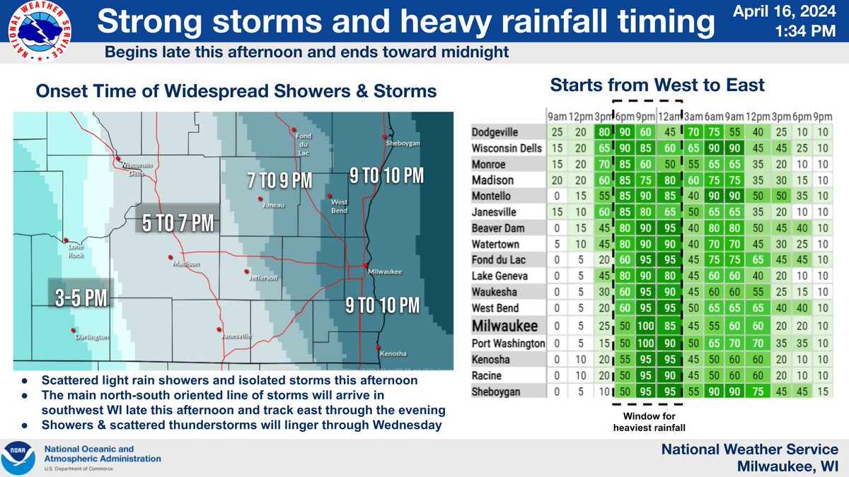
Strong storms and heavy rainfall is still on track for late this afternoon and evening. See timing below. #swiwx
NWS Milwaukee/Sullivan storm spotter classes have been well attended recently. Yesterday was no different in both Delavan and East Troy, WI. Two of our Meteorologists presented with very good interaction. We will continue to hold these thru early May. Thank you spotters! #swiwx


Robert Ljunggren @SwiwX
9 Followers 34 Following

على @mEzSWIwxAJgzh2G
1 Followers 7 Following
سعدة عون @2tcva66SWiwx0dw
0 Followers 0 Following